
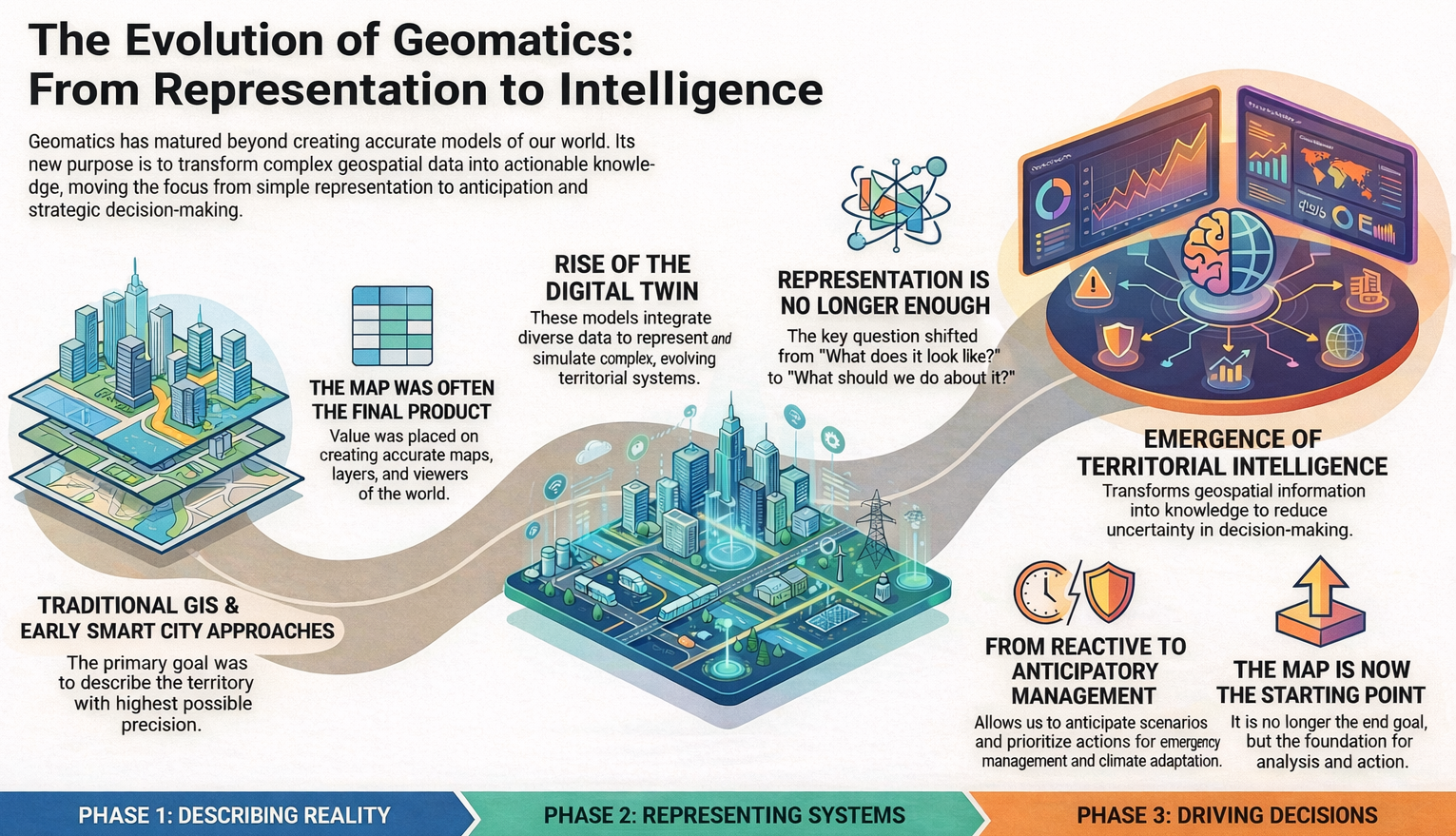
For years, in the field of geomatics, we have worked to describe territory with the highest possible level of accuracy. First came traditional GIS, then the Smart Cities narrative, and more recently the consolidation of the digital twin concept. Each of these terms has served a very specific purpose: helping us explain complex projects and highlight the value of geospatial technology in increasingly broad contexts.
The digital twin has represented an important step forward. It has allowed us to talk about models that integrate heterogeneous data, evolve over time, and represent complex territorial systems in an understandable way. However, as these projects mature, a shared feeling begins to emerge: representing reality well is no longer enough.
The question we hear more and more often is not how the territory looks, but what we do with that information. What is the right decision, when should it be made, and with what consequences. It is at this point that the focus begins to shift.
Geomatics thus enters a new stage, in which value no longer lies solely in the model or the viewer, but in the ability to transform geospatial information into knowledge. Territory ceases to be something that is merely observed and becomes a system that is analyzed, interpreted, and to some extent anticipated.
This is where the concept of territorial intelligence begins to take shape. Not as a break with GIS or digital twins, but as their natural evolution. Models still exist, data remains fundamental, but they are integrated with automated analyses, models, and mechanisms that help reduce uncertainty in decision-making. The map is no longer the end of the process, but the starting point.
This shift is especially evident in areas such as emergency management, territorial planning, or climate change adaptation. In these contexts, it is not enough to know what is happening; it is essential to anticipate scenarios, assess impacts, and prioritize actions. Geomatics, combined with artificial intelligence and advanced analytics, makes this leap possible: moving from reactive management to anticipatory management. This is how we understand it and how we are working with gvSIG Online, integrating disruptive technologies such as Artificial Intelligence.
In this new approach, territory is understood as a system that can be observed, modeled, and simulated, but also interpreted to support critical decisions. Technology, as we have always argued, definitively ceases to be an end in itself and becomes an instrument at the service of management and the public interest.
For years we have talked about maps, layers, and viewers. Then about digital twins. We should start talking about making better decisions, about supporting decisions with real impact. Along this path, geomatics is consolidating itself as a strategic technology, as is free and open-source software, with its commitment to interoperability, transparency, and sustainability.
At gvSIG we have always understood geomatics as more than just a technology: as a tool at the service of public management, decision-making, and the general interest. That is why this evolution toward territorial intelligence is not a fad or a change in discourse, but the natural consequence of years of work on interoperability, open standards, and solutions designed to endure.
The future does not lie in accumulating more data or building ever more complex models, but in putting geospatial information at the service of those who have to make decisions, at the right moment and with the strongest possible support. That is the challenge—and also the responsibility—of geomatics today.
From gvSIG, we will continue working along these lines: developing open technology, integrating new analytical and intelligence capabilities, and contributing to territories that are not only better represented, but also better managed and governed.


