
It’s worth to review MELODA (MEtric for reLeasing Open DAta), a metrics to calculate how much the data are reusable (and now there’s an alfa of an API), where the importance of the geographic component is totally demonstrated when we speak about Open Data.
In fact, MELODA analyzes six dimensions, one of which is the “geolocation” of the information. For each dimension there are 5 levels of reusability that have been considered.
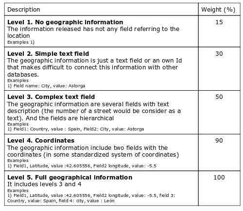
At this picture you can see the levels related to the geographic information:
As many times we affirm, geomatics is becoming a fundamental technology, because data are not understood if they don’t have geographic attribute, and therefore a good management of the information can’t be done without tools that into account the geographic dimension. Tools that we launch from the gvSIG Association with open source software.


