
 We are going to show a curiosity for fictitious maps lovers. OpenGeoFiction is a project based on the OpenStreetMap platform aimed to create a fictitious world. Seas, rivers, cities, countries… a virtual world that grows every day. Therefore, OpenGeoFiction is a world created collaboratively and free by a community…, that can be available on our gvSIG Desktop.
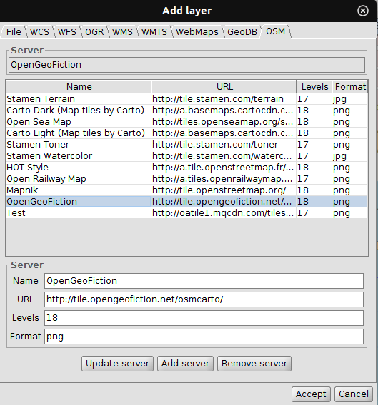
We can add the OpenGeoFiction map service through the ‘OSM’ tab, inside the ‘Add layer’ window, using the following parameters:
- Name: OpenGeoFiction
- URL: http://tile.opengeofiction.net/osmcarto/
- Levels: 18
- Format: png
 Once the server has been added among the available ones, we can add it as a layer to our gvSIG Desktop View. We have to take into account that the view must be in EPSG: 3857, which is the projection used by this world of fiction.


Pingback: OpenGeoFiction: fictitious maps in gvSIG Desktop – GeoNe.ws