
In the day-to-day management of a city council, information is key. But it is not just about having data—it is about knowing how to organize it, keep it up to date, and turn it into useful knowledge for decision-making. This is where the geographic dimension plays a fundamental role: infrastructures, administrative procedures, public services, environment, urban planning, or heritage… almost everything happens in a specific place within the territory.
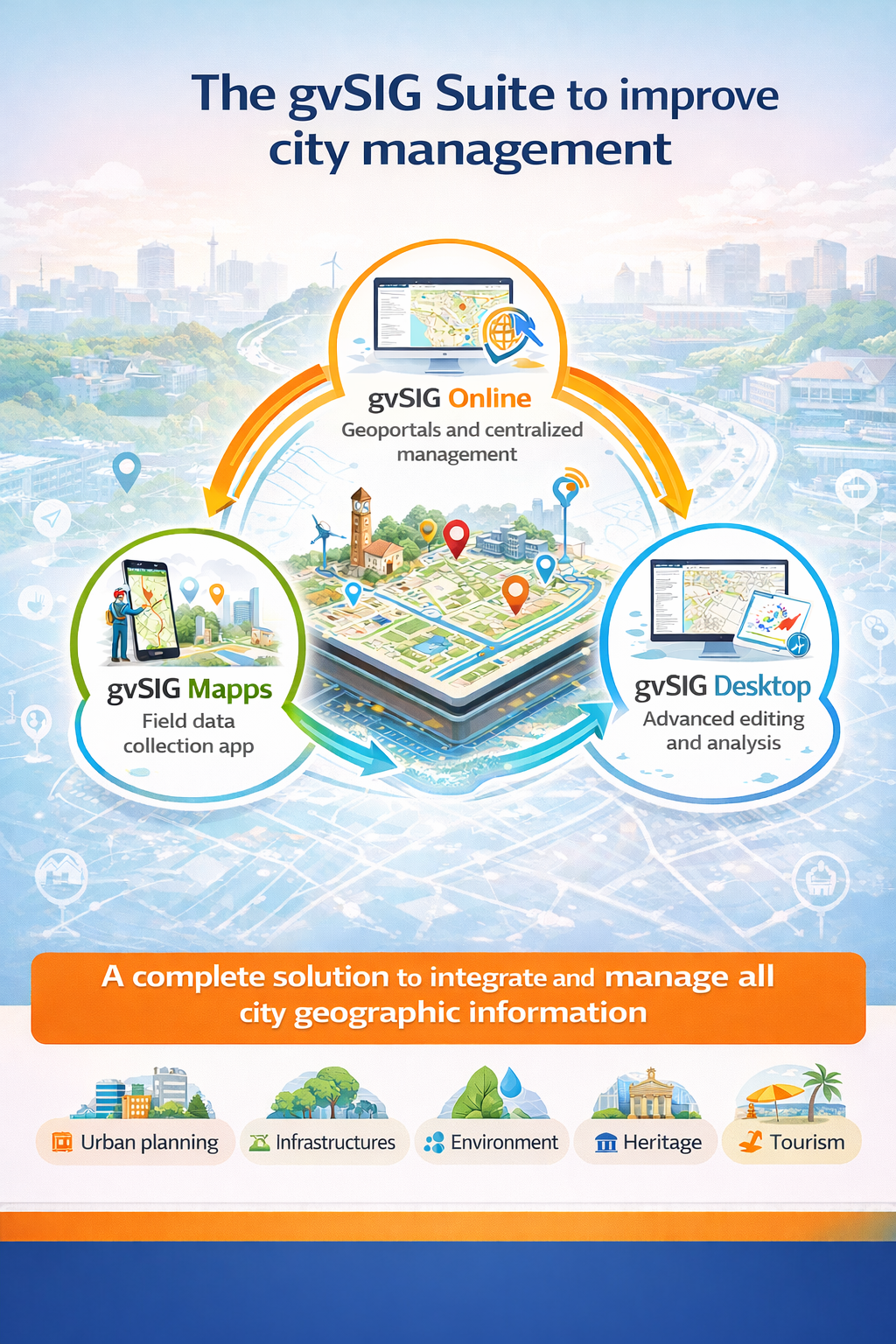
The gvSIG Suite provides a comprehensive response to this challenge by combining three tools that cover the entire lifecycle of municipal geographic information: gvSIG Online, gvSIG Mapps, and gvSIG Desktop.
An integrated municipal geographic system
One of the main challenges faced by many local governments is information fragmentation: duplicated data, different formats, isolated applications, and dependency on closed solutions. The gvSIG Suite proposes a different approach: a shared geographic base, common to all departments and accessible according to each user’s role.
The result is a unified view of the territory that improves internal coordination, reduces errors, and facilitates both technical management and transparency for citizens.
gvSIG Online: the core of municipal geographic information
gvSIG Online acts as the core of the municipality’s Spatial Data Infrastructure (SDI). Through a web browser, it allows local governments to:
- Centralize and catalogue municipal geographic information.
- Easily publish internal and public geoportals.
- Integrate their own cartography with official data and external sources.
- Provide access to information for different departments without requiring advanced GIS knowledge.
Urban planning, environment, infrastructures, tourism, mobility, or heritage management can all work on the same platform, using up-to-date and consistent data.
gvSIG Mapps: the territory starts in the field
A large part of municipal information is generated outside the office: inspections, inventories, censuses, infrastructure maintenance, or incident reporting. gvSIG Mapps brings GIS to the field, turning mobile devices into powerful working tools:
- Capture georeferenced data directly on the map.
- Use forms tailored to each type of inventory or inspection.
- Work online or offline, depending on field conditions.
- Synchronize directly with gvSIG Online, avoiding manual tasks and data duplication.
In this way, information is updated at the source and becomes available almost in real time to the rest of the organization.
gvSIG Desktop: advanced editing and analysis
For technical profiles that require more advanced editing capabilities, gvSIG Desktop completes the ecosystem as a desktop tool for:
- Advanced editing of geographic data.
- Preparation of technical cartography.
- Complex spatial analysis and quality control.
All of this works directly on the same data that is published in gvSIG Online and captured through gvSIG Mapps.
Beyond technology: efficiency and better decision-making
The combination of these three tools is not just a technological solution—it represents a change in the way territory is managed:
- Fewer information silos and greater collaboration between departments.
- More reliable, up-to-date, and reusable data.
- Improved efficiency in administrative processes.
- Greater transparency and better services for citizens.
The gvSIG Suite enables local governments to move from maps as simple visual support to territory as an information system, supporting more modern, sustainable, and decision-oriented municipal management.


