

Download gvSIG Desktop

Recent Comments
Gabi on Algunas notas sobre la Hoja de… 
Cómo descomprimir y… on Cómo crear accesos directos de… Gia W on Jornadas “Uso de las Tec… Alvaro Anguix Alfaro on Aprende a manejar un SIG: Grab… Alvaro on Aprende a manejar un SIG: Grab… Authors
-
Alvaro
-
Amparo Cisneros
-
adelrey
-
Alegria
-
asoredesocial2006
-
Augusta
-
christinesig
-
cordin
-
csanper
-
danielvicb
-
dispiste
-
edmarmoretti
-
elenasanchez232
-
eliazerk
-
fjsolis
-
Gabi
-
ggowtham
-
Giuliano Ramat
-
Valenty
-
Georg Sedlmeir
-
hydrologiclady
-
jgalans
-
Joaquin del Cerro
-
Juan Lucas Domínguez Rubio
-
jolicar
-
josebadia
-
Jorge Piera Llodrá
-
Jordi Torres
-
Chevi
-
learozz
-
leoruizb
-
Alonso Morilla
-
Lluís Marqués
-
martapacoret
-
Óscar Martínez
-
mateoboudon
-
Mario
-
Mario Chaveli
-
mjlobato76
-
Manuel
-
mmontesinos
-
moovida
-
Nacho Varela
-
nbrodin
-
André
-
piotrpachol
-
psanxiao
-
Sergio Acosta y Lara
-
Spatioblog
-
Sergio Acosta y Lara
-
uliwerz
-
Victor Acevedo
-
Viqui
-
volaya
-
gvSIG Batoví 2023, éxitos de llevar la geomática a la educación secundaria
Posted in gvSIG Desktop
Leave a comment
Free workshop on ‘Introduction to gvSIG,’ using version 2.6 and its new icon set at 19th gvSIG Conference
On November 30, 2023, during the 19th International gvSIG Conference, a free workshop will be held to learn to use version 2.6 of gvSIG, showcasing the new icon set.
To participate in the workshop, simply register using the following link: Workshop Registration.
Version 2.6 comes with an improved default icon set, replacing the one used since its initial versions.
This workshop will cover the main tools of the application, creating views, loading vector and raster layers, both locally and remotely, editing them graphically and alphanumeric, applying geoprocessing, and creating maps. All of this will be done using the new icon set, providing a refreshed version of gvSIG.
Whether you’ve used gvSIG before or it’s your first time, you won’t want to miss this workshop.
To follow it, you’ll need to download the portable version 2.6 of gvSIG for your operating system: Windows 64 – Windows 32 – Linux 64 – Linux 32
You’ll have to extract it to a folder without spaces. For example, you can create a folder called ‘gvSIG’ in C:\ (on Windows) or in the user’s home directory (on Linux), place the zip file inside, and extract it there.
You’ll also need to download the cartography to be used: Workshop Cartography ‘Introduction to gvSIG 2.6’
Posted in english, events, gvSIG Desktop, training
Tagged 19th International gvSIG Conference
Leave a comment
Taller gratuito sobre “Introducción a gvSIG”, con la versión 2.6 y su nuevo juego de iconos en las 19as Jornadas gvSIG
El día 30 de noviembre de 2023, durante las 19as Jornadas Internacionales gvSIG, se realizará un taller gratuito sobre el manejo de la versión 2.6 de gvSIG, con el nuevo juego de iconos.
Para seguir el taller solo deberás registrarte desde el siguiente enlace: Inscripción taller.
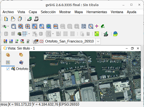
La versión 2.6 incluye por defecto un nuevo juego de iconos mejorado, sustituyendo al que llevaba desde sus versiones iniciales.
En este taller se repasarán las principales herramientas de la aplicación, aprendiendo a crear vistas, cargar capas vectoriales y raster, locales y remotas, a editarlas, tanto gráfica como alfanuméricamente, a aplicar geoprocesamiento y a generar mapas. Todo ello se realizará con el nuevo juego de iconos, que da una versión renovada a gvSIG.
Tanto si ya has utilizado gvSIG previamente, como si es tu primera vez, no puedes perderte este taller.
Para poder seguirlo, deberás descargarte la versión 2.6 portable de gvSIG, según tu sistema operativo: Windows 64 – Windows 32 – Linux 64 – Linux 32
Se deberá descomprimir en una carpeta sin espacios ni acentos ni eñes. Se puede crear por ejemplo una carpeta “gvSIG” en C:\ (en Windows) o en el home de usuario (en Linux), dejar el zip dentro, y descomprimir ahí.
Se deberá también descargar la cartografía a utilizar: Cartografía taller “Introducción a gvSIG 2.6”
Posted in events, gvSIG Desktop, spanish, training
Tagged 19th International gvSIG Conference
Leave a comment
El Proyecto GVSIG, impulsado por la Generalitat Valenciana y la Asociación GVSIG, galardonado como mejor proyecto de software de Europa en los OSOR Awards
El Proyecto GVSIG, una iniciativa conjunta de la Generalitat Valenciana y la Asociación GVSIG, ha sido distinguido con el primer premio en los OSOR Awards. Este galardón reconoce los logros excepcionales que ha logrado el proyecto GVSIG a nivel internacional y reflejan el compromiso continuo de la Generalitat Valenciana con la innovación y la colaboración.
Los OSOR Awards han sido organizados por el Observatorio de Software Libre (OSOR) de la Comisión Europea con motivo de su 15 aniversario, y han querido destacar los mejores proyectos impulsados por las administraciones públicas de toda Europa. En este contexto, GVSIG ha destacado entre todas las nominaciones, convirtiéndose en el ganador de los premios, en los que se ha destacado su impacto global y su contribución al desarrollo tecnológico europeo.
Según los organizadores de los premios se recibieron más de cien candidaturas de 23 países. Tras una primera fase, el jurado seleccionó los seis mejores proyectos, donde GVSIG compartía opciones con proyectos de España, Dinamarca, Italia y Francia. Durante el evento organizado en el día de ayer en Bruselas, los seis proyectos tuvieron que defender su candidatura ante el jurado de la Comisión Europea. Finalmente fue anunciado el ganador: el proyecto GVSIG presentado conjuntamente por la Generalitat Valenciana y la Asociación GVSIG.
El Proyecto GVSIG es un catálogo de herramientas informáticas para gestión de información geográfica que desde su nacimiento en 2004 ha ido ganado reconocimiento por su versatilidad y utilidad en una variedad de sectores, desde la gestión de recursos naturales hasta la planificación urbana. La Generalitat Valenciana ha desempeñado un papel fundamental tanto en su impulso inicial como en el respaldo continuo al proyecto. La Asociación GVSIG, por su parte, ha desempeñado un papel esencial en la promoción y difusión de esta plataforma a nivel internacional, facilitando la generación y crecimiento de un sector empresarial valenciano especialista en tecnologías de información geográfica. Un ejemplo de colaboración público-privada que ahora obtiene el reconocimiento de Europa.
Este prestigioso galardón no solo reconoce el éxito del Proyecto GVSIG, sino que también destaca el compromiso de la Generalitat Valenciana y la Asociación GVSIG con la promoción de soluciones tecnológicas abiertas y accesibles, fomentando la innovación y la colaboración como motor de desarrollo.
GVSIG da solución a todas las necesidades relacionadas con la geolocalización y la administración del territorio. En la Generalitat Valenciana se multiplican sus usuarios y entre los diversos ejemplos de uso se encuentran desde aplicaciones para ayudar a proteger las praderas fanerógamas, la conocida posidonia, evitando fondear en zonas protegidas a aplicaciones de gestión del registro vitivinícola, pasando por soluciones para fomentar la movilidad sostenible mediante un planificador de rutas más versátil que el propio Google Maps o aplicaciones para analizar los accidentes de tráfico.
Si su uso es transversal en la Generalitat Valenciana, otro tanto ocurre a nivel global. Son innumerables las entidades de todo tipo que utilizan esta tecnología valenciana. En la presentación de los OSOR Awars se citaron varias de ellas. A nivel supranacional entidades como Naciones Unidas la han adoptado como tecnología de referencia en usos tan destacados como facilitar la seguridad de las misiones de los Cascos Azules en sus desplazamientos ante ataques terroristas. A nivel nacional ha sido igualmente adoptada, contando casos tan significativos como el del Gobierno de Uruguay, donde GVSIG es la base tecnológica para todos los proyectos de gestión y difusión de información territorial del país, habiendo servido también para crear un sistema único de direcciones. En Uruguay ha sido tal el nivel de adopción que en la educación secundaria es utilizada para el aprendizaje de las materias relacionadas con la geografía. Su uso a nivel regional y local nos lleva a citar ejemplos como el del Estado de Tocantins en Brasil, donde se ha convertido en la plataforma de gestión geográfica y estadística o el Gobierno de Córdoba en Argentina, donde es utilizada para analizar los datos de criminalidad y seguridad ciudadana. Y donde todavía está más implantada es en las administraciones locales, donde GVSIG está siendo adoptada a gran velocidad por decenas de ayuntamientos de toda España; los últimos han sido los Ayuntamientos de Alicante, Albacete, Cartagena y Talavera de la Reina. Solo en la Comunidad Valenciana el número de ayuntamientos que confían en GVSIG es innumerable: Cullera, Onda, Picassent, L’Eliana, La Pobla de Vallbona, Nàquera, Alzira, Benicarló… e igualmente otras entidades valencianas han adoptado GVSIG como el Consorcio Provincial de Bomberos de Valencia, donde su uso se centra en la gestión de emergencias. Y más allá de la administración pública, cuya relación con el territorio es directa, GVSIG también ha entrado a formar parte de las soluciones informáticas que utilizan empresas que trabajan con información geoposicionada, como es el caso de Repsol que hace un uso extensivo de GVSIG en su división de energías renovables.
El premio otorgado a la Generalitat Valenciana y a la Asociación GVSIG se suma a otros galardones obtenidos anteriormente, de entidades tan diversas como el Diario Expansión o la NASA.
GVSIG es un referente en lo que se ha denominado Infraestructuras de Datos Espaciales, la puesta en marcha de plataformas que permitan a las administraciones públicas compartir su información geográfica mediante estándares.
El impacto del proyecto tiene numerosas derivadas, a nivel académico se imparte formación en GVSIG en universidades de todo el mundo, se publican anualmente cientos de artículos científicos donde se utiliza GVSIG como herramienta de los investigadores, se multiplican las conferencias y eventos donde se presentan todo tipo de proyectos desarrollados con GVSIG.
GVSIG, un proyecto basado en el conocimiento libre, ejemplo de colaboración público-privada que sitúa a Valencia como uno de los indiscutibles polos de referencia en el ámbito de la geomática, la tecnología aplicada a la dimensión geográfica de la información. El premio obtenido ayer es un reconocimiento a todo el camino recorrido.
Recientemente ha sido nominado al Premio Nacional de Ciencias Geográficas, todavía por resolver. Lo que nos han confirmado fuentes de la Asociación gvSIG es que esta candidatura ha recibido más de 150 cartas de apoyo de entidades de todo el mundo, desde el Departamento de Transporte de Washington al Ordnance Survey, la agencia cartográfica del Reino Unido.
Posted in gvSIG Desktop
Leave a comment
The GVSIG Project, driven by the Generalitat Valenciana and the GVSIG Association, awarded as the best software project in Europe at the OSOR Awards
The GVSIG Project, a joint initiative of the Generalitat Valenciana and the GVSIG Association, has been honored with the first prize at the OSOR Awards. This award recognizes the exceptional achievements of the GVSIG project on an international level and reflects the ongoing commitment of the Generalitat Valenciana to innovation and collaboration.
The OSOR Awards were organized by the Observatory of Open Source Software (OSOR) of the European Commission on the occasion of its 15th anniversary, aiming to highlight the best projects driven by public administrations throughout Europe. In this context, GVSIG stood out among all nominations, becoming the winner of the awards, emphasizing its global impact and contribution to European technological development.
According to the award organizers, over a hundred nominations from 23 countries were received. After an initial phase, the jury selected the top six projects, where GVSIG competed alongside projects from Spain, Denmark, Italy, and France. During the event held yesterday in Brussels, the six projects had to defend their candidacy before the European Commission’s jury. Finally, the winner was announced: the GVSIG project jointly presented by the Generalitat Valenciana and the GVSIG Association.
The GVSIG Project is a catalog of computer tools for geographic information management that, since its inception in 2004, has gained recognition for its versatility and usefulness in various sectors, from natural resource management to urban planning. The Generalitat Valenciana has played a fundamental role in both its initial promotion and continuous support for the project. The GVSIG Association, in turn, has played an essential role in promoting and disseminating this platform internationally, facilitating the generation and growth of a Valencian business sector specializing in geographic information technologies. An example of public-private collaboration that now receives recognition from Europe.
This prestigious award not only acknowledges the success of the GVSIG Project but also highlights the commitment of the Generalitat Valenciana and the GVSIG Association to promoting open and accessible technological solutions, fostering innovation and collaboration as drivers of development.
GVSIG addresses all needs related to geolocation and territory management. Its users in the Generalitat Valenciana are multiplying, and among various use cases are applications to help protect seagrass meadows, such as the well-known posidonia, by avoiding anchoring in protected areas, applications for managing the vineyard registry, and solutions to promote sustainable mobility through a route planner more versatile than Google Maps itself, or applications to analyze traffic accidents.
If its use is widespread in the Generalitat Valenciana, the same is true globally. Countless entities of all kinds use this Valencian technology. Several were mentioned in the presentation of the OSOR Awards. At the supranational level, entities like the United Nations have adopted it as a reference technology for prominent uses, such as enhancing the security of Blue Helmets’ missions during their travels in the face of terrorist attacks. Nationally, it has been similarly adopted, with significant cases such as the Government of Uruguay, where GVSIG is the technological basis for all territorial information management and dissemination projects in the country, also serving to create a unique addressing system. In Uruguay, its adoption is so extensive that it is used in secondary education for learning subjects related to geography. Its use at the regional and local levels leads to examples such as the State of Tocantins in Brazil, where it has become the platform for geographic and statistical management, or the Government of Córdoba in Argentina, where it is used to analyze crime and public safety data. It is even more deeply entrenched in local administrations, with GVSIG being rapidly adopted by dozens of municipalities throughout Spain, including the recent additions of the municipalities of Alicante, Albacete, Cartagena, and Talavera de la Reina. In the Valencian Community alone, the number of municipalities trusting GVSIG is countless: Cullera, Onda, Picassent, L’Eliana, La Pobla de Vallbona, Nàquera, Alzira, Benicarló, and many other Valencian entities have also adopted GVSIG, such as the Provincial Fire Consortium of Valencia, where its use focuses on emergency management. Beyond the public administration, whose relationship with the territory is direct, GVSIG has also become part of the computer solutions used by companies working with geopositioned information, such as Repsol, which extensively uses GVSIG in its renewable energy division.
The award granted to the Generalitat Valenciana and the GVSIG Association adds to other accolades previously obtained from diverse entities such as Diario Expansión or NASA.
GVSIG is a reference in what is called Spatial Data Infrastructures, the implementation of platforms that allow public administrations to share their geographic information through standards.
The impact of the project has numerous ramifications; academically, GVSIG training is offered at universities worldwide, hundreds of scientific articles are published annually using GVSIG as a tool by researchers, and conferences and events showcasing various projects developed with GVSIG abound.
GVSIG, a project based on free knowledge, is an example of public-private collaboration that positions Valencia as one of the undisputed reference hubs in the field of geomatics, technology applied to the geographic dimension of information. The award obtained yesterday is recognition for the entire journey taken.
Recently, it has been nominated for the National Geographic Sciences Award, still pending resolution. Sources from the GVSIG Association have confirmed that this candidacy has received more than 150 letters of support from entities worldwide, from the Department of Transportation in Washington to the Ordnance Survey, the cartographic agency of the United Kingdom.
Posted in gvSIG Desktop
1 Comment
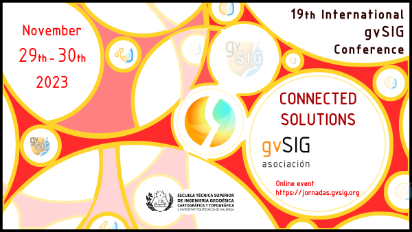
Program of 19th International gvSIG Conference (online) is now available, and registration (free of charge) period is open
Free registration period for the 19th International gvSIG Conference is now open. The Conference is an online event, and it will be held from November 29th to 30th.
The full program of the Conference is available on the event website, where registration to the different sessions can be done.

The webinar platform allows to connect to the webinars from any operating system, and in case you can’t follow them, you will be able to watch them at the gvSIG Youtube channel later.
In reference to workshops, all the information about cartography and gvSIG version to install will be published at the gvSIG blog before the conference.
Don’t miss it!
Programa e inscripciones gratuitas abiertas para las 19as Jornadas Internacionales gvSIG (online)
Ya están abiertas las inscripciones gratuitas para las 19as Jornadas Internacionales gvSIG, que se celebrarán de forma online los días 29 y 30 de noviembre.
El programa completo está disponible en la página web del evento, desde donde se puede realizar la inscripción a cada una de las ponencias.

La plataforma de webinar permite conectarse desde cualquier sistema operativo, y en caso de no poder seguirlos en directo se podrán ver a posteriori, ya que se publicarán en el canal de Youtube del proyecto al igual que en años anteriores.
Respecto a los talleres, en el blog de gvSIG informaremos sobre la cartografía a descargar para seguirlos, así como de la versión de gvSIG a instalar.
Posted in gvSIG Desktop
Leave a comment
19th International gvSIG Conference: Communication proposals submission is open
The 19th International gvSIG Conference “Connected solutions” will be held on November 29th and 30th, 2023. Within the in-person and online alternation, this year the conferences will be held as online event, which facilitates participation both in terms of presentations/workshops and attendance.
The communication proposals submission is now open, which can be sent to the email address conference-contact@gvsig.com, following the information indicated in the Communications section of the conference website.
As always, registration for the conference will be free of charge, and will be able to be done once the program has been published.
We encourage you to participate!
19as Jornadas Internacionales de gvSIG: abierto el periodo de envío de propuestas de comunicación

Los días 29 y 30 de noviembre de 2023 tendrán lugar las 19as Jornadas Internacionales de gvSIG “Soluciones conectadas”. Dentro de la alternancia presencial-online, este año se realizan las jornadas en modalidad online, lo que facilita la participación tanto a nivel de ponencias/talleres como de asistencia.
Ya está abierto el periodo de envío de propuestas de comunicación, que pueden enviarse a la dirección de correo electrónico conference-contact@gvsig.com, siguiendo la información indicada en el apartado «Comunicaciones» de la web de las jornadas.
Como siempre, la inscripción a las jornadas será gratuita, y podrá realizarse una vez publicado el programa de las mismas.
¡Os animamos a participar!
Posted in events, spanish
Leave a comment
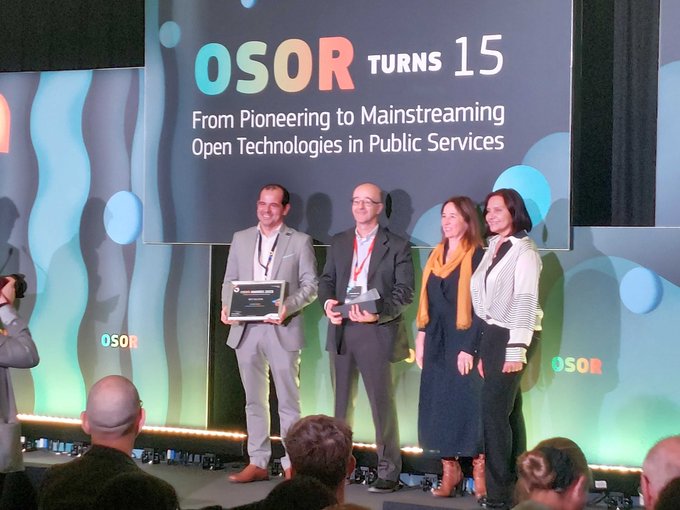
Osor Awards: gvSIG selected among the top 6 open-source projects by the European Commission

We have reason to celebrate. The gvSIG project, submitted by the Generalitat Valenciana and the gvSIG Association, has been chosen by the Osor Awards jury as one of the top 6 open-source projects. Undoubtedly, this is a recognition of the highest caliber for the work carried out by these institutions and the entire gvSIG community around the project.
About Osor Awards
The European Commission’s Open Source Observatory (OSOR) has organised the EU Public Services Open Source Achievement Awards to honour and showcase the best open source solutions and initiatives created by or for the public administrations in Europe.
As the title of the Awards indicates, the Jury focused on achievements of open source solutions and initiatives: the ambitious goals, determination in overcoming challenges, contribution towards furthering democracy, transparency and active participation of citizens in creating digital infrastructures serving constituents, the impact on their communities, and effective usage of public resources and exceptional response to solving problems.
Award ceremony
The representatives of the top 6 entries and the winner of the OSOR Community Award will be invited to Brussels for the event celebrating 15 years of our Observatory – OSOR Turns 15: From Pioneering to Mainstreaming Open Technologies in Public Services on 21 November 2023.
… We’re going to Brussels!
Posted in gvSIG Desktop
1 Comment


