
Two available extensions, derived by the gvSIG Batoví project, add very interesting functions for gvSIG 2.0 users.
These two extensions are available through the add-ons manager as:
- Thematic Maps generator
- Thematic Maps viewer document
By using both of them it will be possible to work with a new type of document so called “Thematic Map”.
“Thematic Maps” are, in truth, a new type of View offering to the user basic options of querying. The Project gvSIG Batoví aimed originally to provide students, from primary and secondary school, with a tool to easily share maps, without the complex tools available in the gvSIG interface. They can be also a nice base to produce cartographic viewers.
See how it is possible to produce “Thematic maps” from any “View” and convert this “Thematic Map” in a package that can be installed from any gvSIG (through the add-ons manager). In such a way we can package a “View” with its own legends, layers, labels and …and distribute to other gvSIG users.
For sure the best way to share information is the Spatial Data Infrastructures, but at small scale and for an easy sharing, “Thematic maps” can represent an interesting tool.
In this video, how to install the application is detailed:
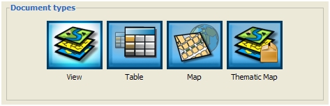
When gvSIG restarts, a new document type appears.
In this first post, we will see how to create a “thematic map” from a “View”.
Create a first thematic map from a “View” with some loaded layers and customized. It is as simple as from our own “View” go to “Thematic Map” and select “Crete from View”. A new window appears where it will be possible to add the characteristics of our map.
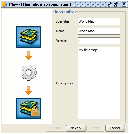
Press on “Next” and check that everything is fine. If any of the previous fields has not been filled, a warning appears, even if it is just for information since the procedure continues allowing users to create the “thematic map”.
Description field can be also used to provide information about use of specific symbols libraries in order that, users sharing this thematic map, know that they have to install that library to be able to correctly visualize the map.
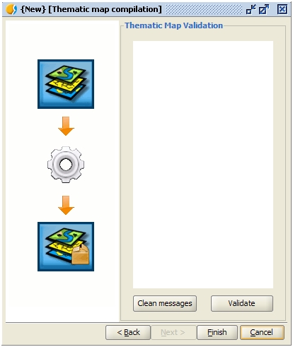
Press on “Finish” and gvSIG automatically creates the new document:

In the next post we will show how to create packages and share “thematic maps” with other users.


Pingback: gvSIG 2.0: the improvements we never talk about | gvSIG blog
Pingback: gvSIG 2.0: Thematic Maps II | gvSIG blog
Pingback: gvSIG 2.0: some tricks with folders | gvSIG blog