
During the next 13th International gvSIG Conference there will be a workshop about “Hydro-geomorphological Modelling in gvSIG with the JGrasstools plugins” in English. It will take place in October 19th.
Introduction
The climate change and the recent extreme events occured all over the world draw again the attention to the natural hazards both for prevention and for management aspects. In this context, environmental modelling can help in mapping hazards and risks zones and to support decision makers in building functional infrastructures with low environment impact.
In the context of modelling natural hazards hydro-geomorphology analysis is a key aspect. In the last decades many researchers tried to extract useful information from digital data and in particular from Digital Terrain Models (DTM) with the development of ad-hoc algorithms and tools. In the meanwhile the data availability increased and high precision DTM are available almost all over the world.
There are many possibilities to analise natural hazards and to define hazard and risks zones as required by the national and international directives. The algorithms contained in the JGrassTools library are the result of more than 10 years of research, development and real application of people from different research institutes and professionals working in the field of natural hazards. The JGrassTools library contains tools for data management (raster, vector and point cloud), data collection in the field, and environmental modelling in particular related to hillslope stability and flooding.
Target audience
The expected participant is the average GIS user that wants to approach new tools for environmental modelling related in particular to flooding hazard. The user can be a professional, a person of the public administration or even a decision maker who has average knowledge of GIS and GIS data and wants to approach this topic.
What will be shown?
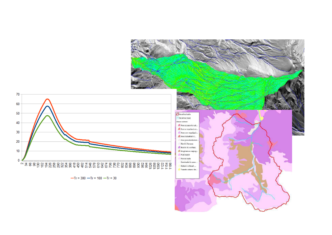
The workshop will cover the main aspects of the hydro-geomorphological analysis of a river basin starting from a DTM. The aim is to evaluate the maximum discharge that can occur in a section for different return times following the rules of the EU Flood Directive. Some generic geomorphological analysis on the DTM will be performed that will be used to delineate the stream network and the watershed closed at the desired section, i.e. the flow directions, the total contributing areas and the slopes.
The last step will be the evaluation of the maximum discharges using the semi distributed model Peakflow (Rigon et al., 2011) integrated in the JGrassTools library.
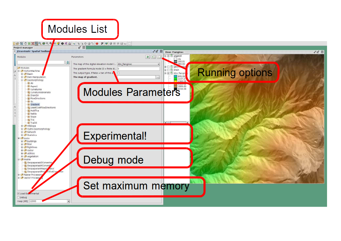
Software and data
The last version of gvSIG will be used and the workshop will start with the installation of the JGrassTools plugins for all the participants both for the local available PC and for the private PC if there will be some.
During the next weeks the link to download the cartography will be available at this post for the participants that will carry their own laptop. The data will be loaded directly on the local PC.
How to subscribe?
To attend the workshop it is necessary to subscribe first to the conference and then to the workshop. All the workshops, as the rest of the conference, are free of charge, but the number of participants is limited.
The workshop will be at the Escuela Técnica Superior de Ingeniería Geodésica, Cartográfica y Topográfica (UPV), and there will be PC ready with software and data. If desired it is possible also to use private laptops.
The full program of the conference is available here:
http://www.gvsig.com/en/events/gvsig-conference/13th-international-gvsig-conference/program
Registration to the conference:
http://www.gvsig.com/en/events/gvsig-conference/13th-international-gvsig-conference/registration
The registration to the workshops will open on the 28th of September through this link:
http://www.gvsig.com/en/events/gvsig-conference/13th-international-gvsig-conference/workshop-registration


Hola a todos, querría adjuntar que nosotros hablamos en poquito de Español entonces no hay problema si algún quiere participar y no habla fluentemente el Ingles, se puede hacer egualmente!
Hasta pronto!
Silvia