
 If a few days ago we presented the abilities of working in gvSIG Online with vector data in 4D, today we show you how you can also work with temporary series of images.
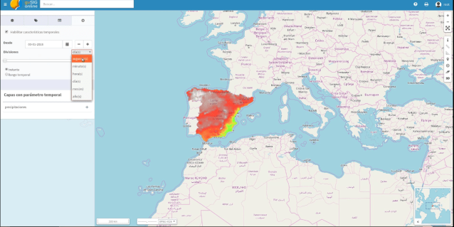
In the video of this post we can see the process to publish raster from different dates in a geoportal. The steps to be followed are:
- We upload the data to the platform. In this case we upload 4 images from different dates.
- We indicate that this set of images is a time series in gvSIG Online.
- We publish the mosaic of temporary images, configuring the temporary parameter. The list of available layers to use is shown in the geoportals.
- We create a geoportal with that layer (the temporary raster series). We check that it is displayed.
- To improve the visualization we apply a colour layer.
- We can see the changes in the geoportal and we use the temporary filter to consult the data.


Pingback: Raster time series in an SDI: Temporary image mosaics in gvSIG Online – GeoNe.ws