Leyes del Suelo y el papel de las IDE municipales

En muchos países y regiones, las administraciones públicas están revisando su legislación urbanística y territorial con un objetivo común: simplificar procedimientos, reducir cargas administrativas y adaptar la gestión del territorio a una realidad cada vez más compleja y dinámica.

La Comunitat Valenciana es un ejemplo reciente de este proceso, con el impulso de una nueva Ley del Suelo que parte de un diagnóstico ampliamente compartido: procedimientos excesivamente largos, sobrecarga documental, duplicidades y dificultades para coordinar información entre departamentos y administraciones. Un escenario que, en mayor o menor medida, se repite en muchos otros territorios.

Más allá del caso concreto, esta reforma pone de relieve una idea clave: la modernización normativa exige apoyarse en infraestructuras digitales sólidas.

Del urbanismo en papel al urbanismo basado en datos

Las nuevas orientaciones normativas apuntan a:

  • Procedimientos más ágiles
  • Planeamiento más flexible
  • Mayor peso de la gestión y el seguimiento frente al documento estático
  • Mejor coordinación de informes sectoriales

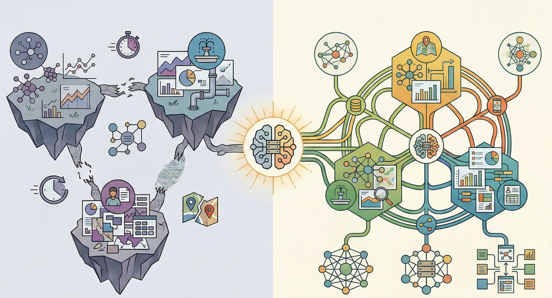
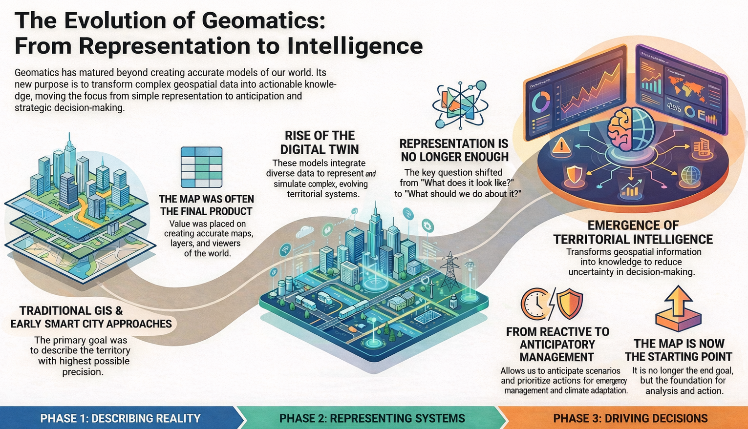
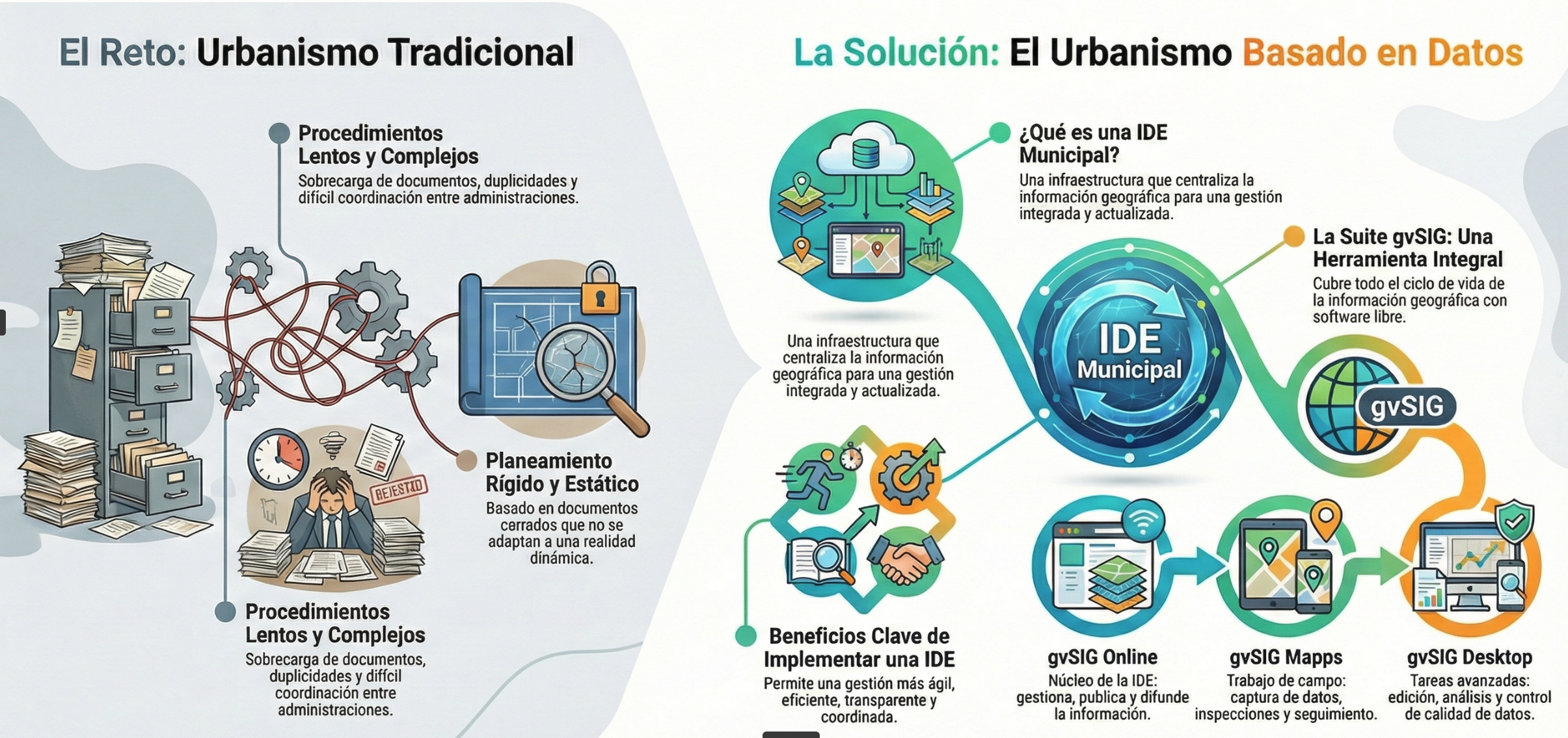
Este enfoque supone un cambio de paradigma: el planeamiento deja de ser únicamente un conjunto de documentos cerrados para convertirse en un sistema vivo, basado en información geográfica actualizada, interoperable y reutilizable.

La IDE como infraestructura pública esencial

En este contexto, las Infraestructuras de Datos Espaciales (IDE) pasan de ser una solución técnica a convertirse en una infraestructura pública básica, comparable a otros sistemas corporativos clave de las administraciones.

Una IDE municipal permite:

  • Centralizar la información urbanística y territorial
  • Reducir duplicidades e incoherencias
  • Facilitar la interoperabilidad entre administraciones
  • Apoyar la toma de decisiones con una visión integrada del territorio

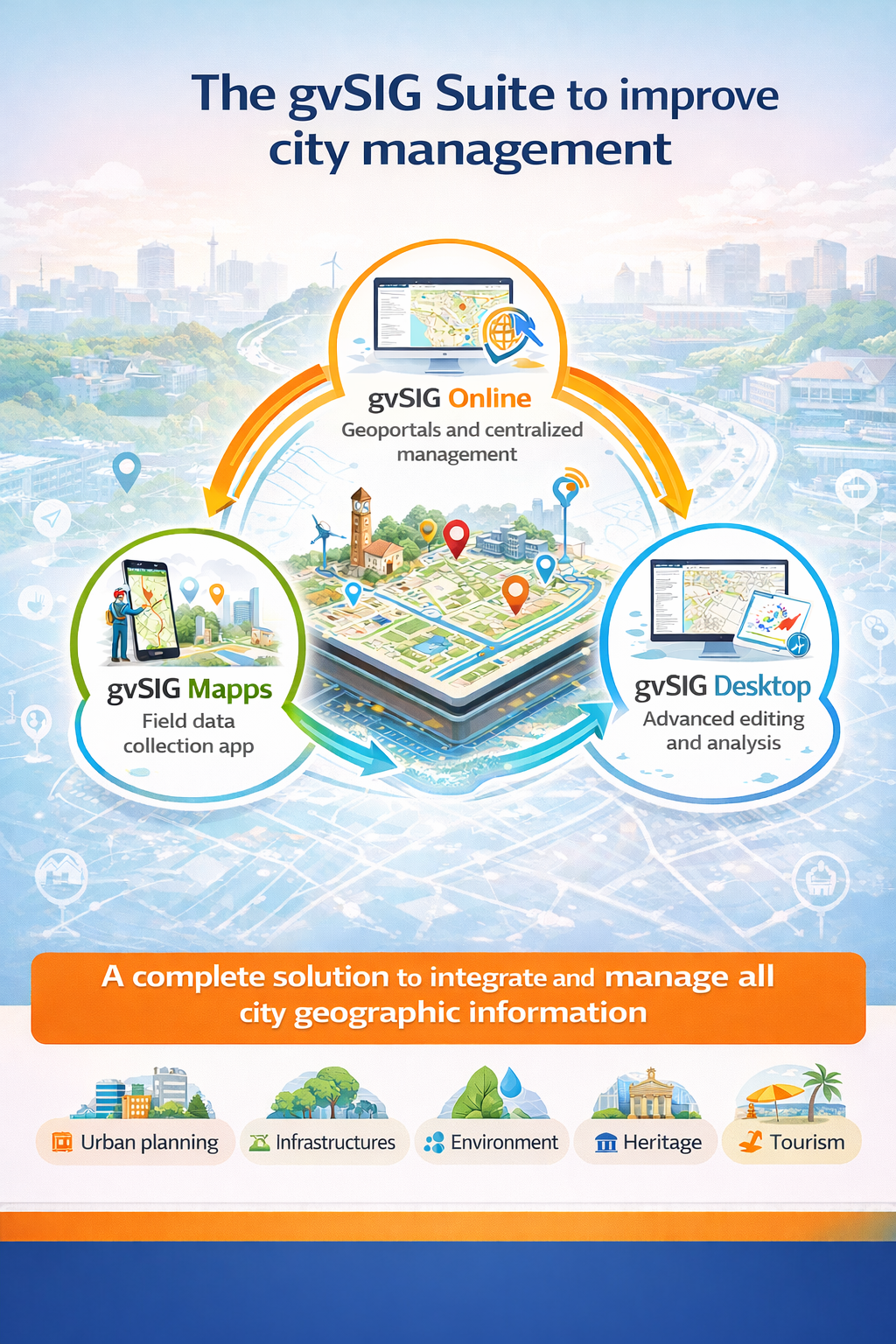
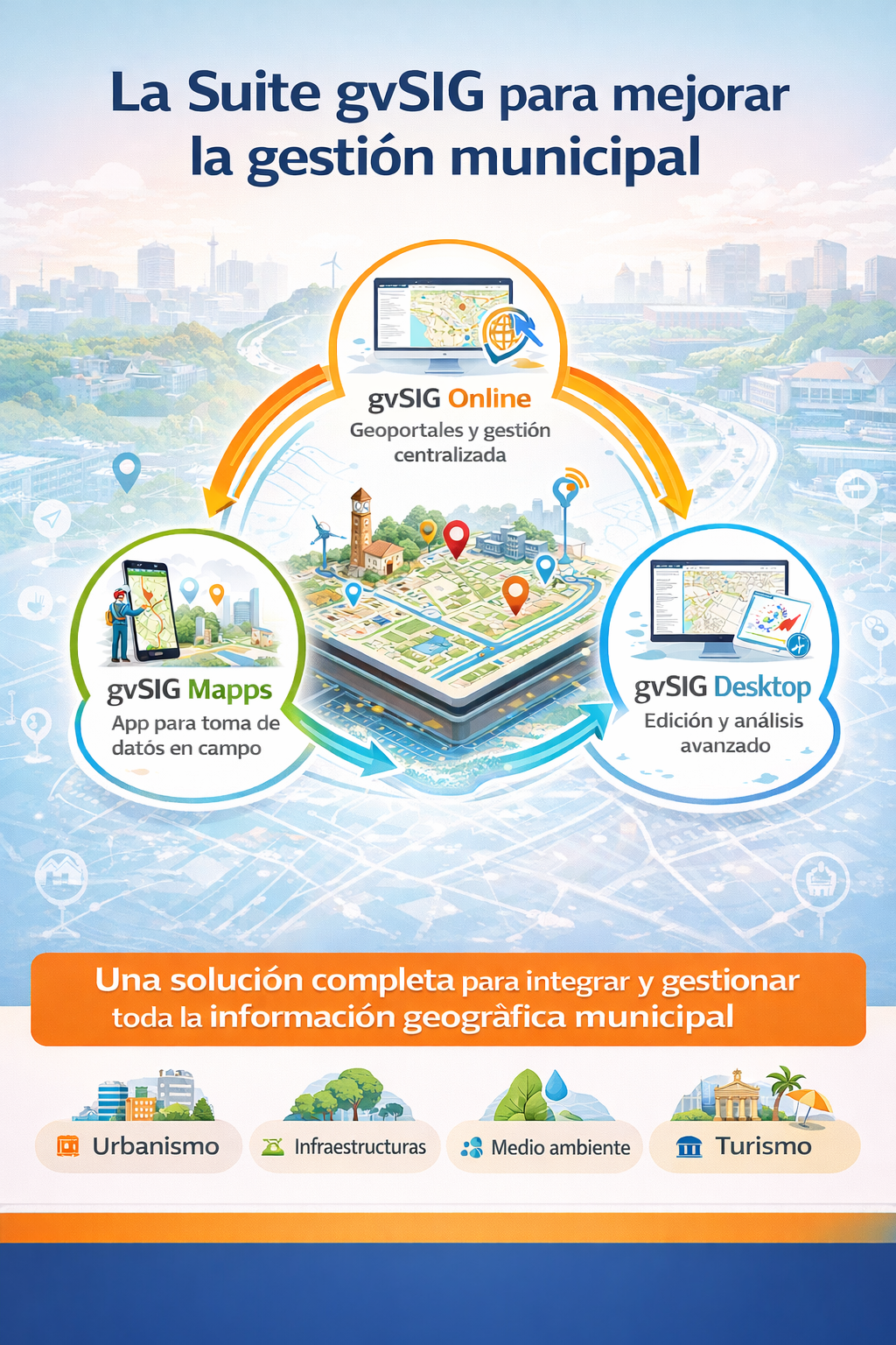
La Suite gvSIG como respuesta práctica

La Suite gvSIG encaja de forma natural en este escenario, ofreciendo una solución completa y basada en estándares abiertos:

  • gvSIG Online, como núcleo de la IDE, para la gestión, publicación y difusión de la información territorial y urbanística.
  • gvSIG Mapps, para llevar a cabo tareas de captura de información en campo, inventarios, inspecciones y seguimiento de actuaciones
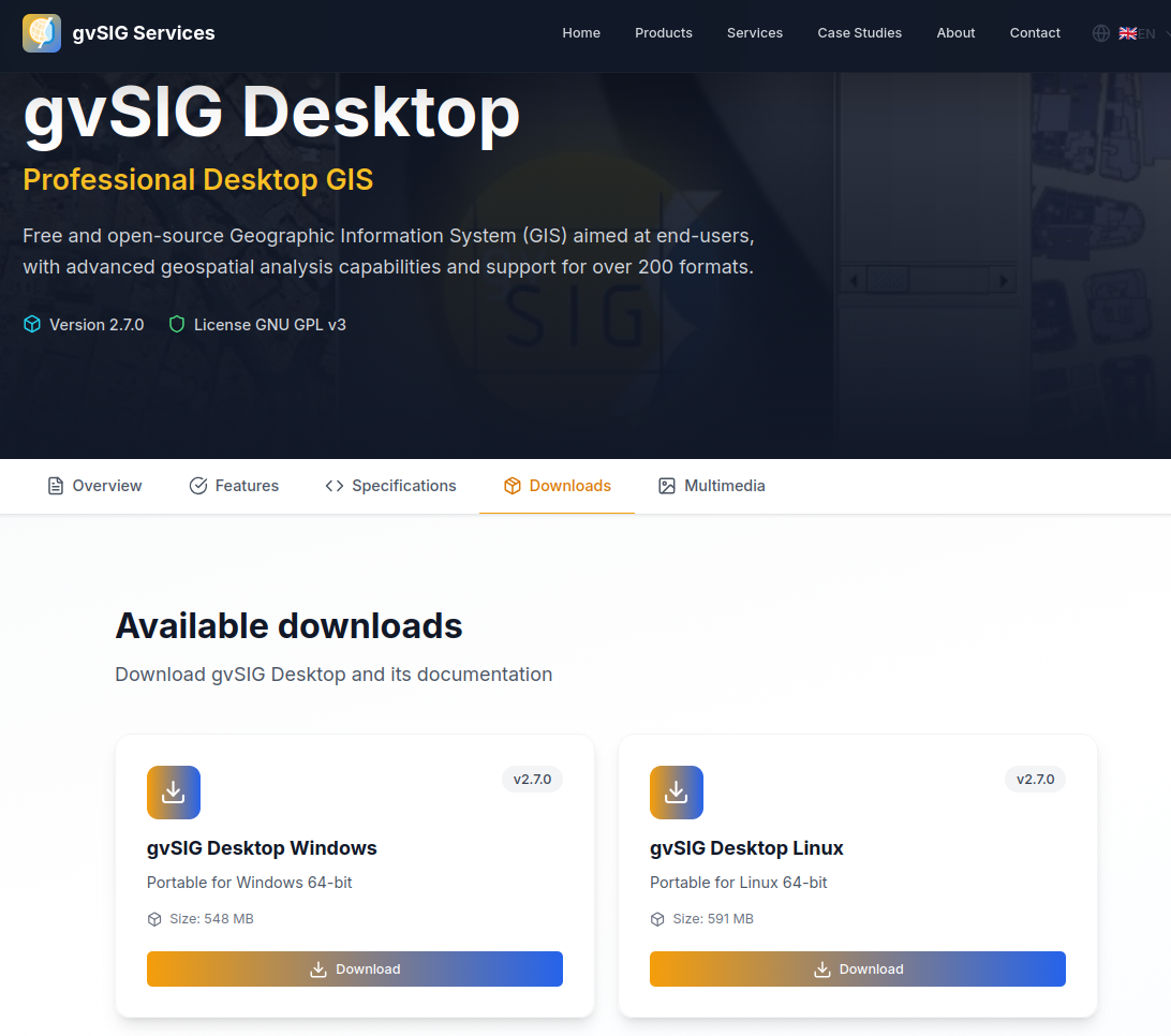
  • gvSIG Desktop, como herramienta avanzada para la edición, el análisis y el control de calidad de los datos para aquellos casos en que se requiera..

Conjuntamente, estas herramientas cubren todo el ciclo de vida de la información geográfica, desde su generación hasta su uso en la toma de decisiones y la comunicación con la ciudadanía.

Una oportunidad compartida para la gestión local

Aunque cada territorio tiene su propio marco normativo, el mensaje es común: simplificar la gestión urbanística requiere ordenar y estructurar bien la información. Y esa información, en gran medida, es geográfica.

Por ello, procesos como el que se está viviendo en la Comunitat Valenciana pueden leerse como un ejemplo extrapolable a otros contextos, donde las IDE y las plataformas geográficas integradas se convierten en un pilar fundamental para una gestión territorial más eficiente, transparente y orientada al servicio público.

La Suite gvSIG y, en especial gvSIG Online como solución integral de gestión de información territorial, está implantada cada vez en más y más administraciones locales (ayuntamientos grandes, medianos y pequeños, diputaciones, mancomunidades… ).

Es el momento de unirte.

Posted in geoportal, gvSIG Desktop, gvSIG MApps, gvSIG Online, gvSIG Suite, IDE, municipios, software libre, spanish | Tagged , | Leave a comment

Technological sovereignty: when dependency is no longer an option

For years, at gvSIG we have insisted on a concept that was often dismissed as ideological, romantic, or even naïve: technological sovereignty.

Today, in a context marked by geopolitical tensions, supply chain disruptions, and structural dependence on external technologies, this concept has moved beyond academic debate to become a strategic necessity.

Europe imports around 80% of its digital infrastructure and technologies. This is not only an economic issue: it is a political, operational, and democratic vulnerability. We depend on decisions taken outside our legal frameworks, our interests, and, in many cases, our values.

The question is no longer whether we want technological sovereignty.
The question is what happens if we do not have it.

Sovereignty is not about borders, it is about control

Talking about technological sovereignty does not mean isolation, building digital walls, or abandoning international collaboration. It means something far more concrete and practical: maintaining control.

Control over:

  • how the technologies we use actually work,
  • who can audit them,
  • who decides their evolution,
  • and what happens if tomorrow the provider disappears, changes the rules, or responds to external interests.

Hosting data in a European data centre is important, but it is not enough.
Real sovereignty is not achieved by simply moving servers.

The four pillars of real technological sovereignty

European discussions increasingly refer to four key dimensions that align remarkably well with what gvSIG has defended for years:

1. Security sovereignty

Trust is not enough: verification is essential. The ability to audit code, processes, and security mechanisms is critical, especially in public and regulated sectors.

2. Operational sovereignty

Who operates the system, who deploys it, who can modify it, and under what conditions. Without operational control, sovereignty remains purely theoretical.

3. Data sovereignty

Where data is stored, how it is processed, and—crucially—which external legal frameworks may affect it, often without users even realising it.

4. Technical sovereignty

Perhaps the most overlooked—and the most important. Using open standards and open source software is not a philosophical stance; it is the only way to avoid irreversible vendor lock-in.

Open source: a necessary (though not sufficient) condition

Open source software does not automatically guarantee sovereignty, but without open source, sovereignty is simply impossible.

Access to source code:

  • enables auditing,
  • allows adaptation,
  • makes long-term evolution possible,
  • and allows changing providers without rebuilding everything from scratch.

At gvSIG, we have always defended that technology should serve people and institutions—not the other way around. That is why we are committed to open standards, real interoperability, and technical communities that do not depend on a single company or country.

This is no coincidence.
It is a political decision in the best sense of the word.

An open ecosystem versus structural dependency

Technological sovereignty is not built with isolated products, but with ecosystems: public administrations, local companies, universities, technical communities, and end users collaborating on equal footing.

This approach:

  • strengthens local technological capacity,
  • reduces systemic risks,
  • fosters real competition,
  • and enables long-term evolution without being trapped in closed solutions.

Exactly the opposite of becoming a digital colony, as some European representatives have already warned.

gvSIG: technological sovereignty before it became urgent

When gvSIG was created, the dominant discourse was different. The focus was on efficiency, cost reduction, and “not reinventing the wheel”.

Today, without renouncing any of that, we know that the real value lies in autonomy, resilience, and the ability to decide.

Technological sovereignty is not a recent trend for us.
It is the common thread running through the entire project.

And in the coming years, it will likely become one of the most critical debates for Europe’s digital future.

Posted in community, english, gvSIG Association, opinion | Tagged , | Leave a comment

Soberanía tecnológica: cuando la dependencia deja de ser una opción

Durante años, en gvSIG hemos insistido en un concepto que muchas veces se despachaba como ideológico, romántico o incluso ingenuo: la soberanía tecnológica.
Hoy, en pleno contexto de tensiones geopolíticas, disrupciones en las cadenas de suministro y dependencia estructural de tecnologías externas, ese concepto ha dejado de ser un debate académico para convertirse en una necesidad estratégica.

Europa importa alrededor del 80 % de su infraestructura y tecnología digital. Esto no es solo una cuestión económica: es una vulnerabilidad política, operativa y democrática. Dependemos de decisiones tomadas fuera de nuestro marco legal, de nuestros intereses y, en muchos casos, de nuestros valores.

La pregunta ya no es si queremos soberanía tecnológica.
La pregunta es qué pasa si no la tenemos.

La soberanía no va de fronteras, va de control

Hablar de soberanía tecnológica no significa aislarse, ni levantar muros digitales, ni renunciar a la colaboración internacional. Significa algo mucho más concreto y práctico: mantener el control.

Control sobre:

  • cómo funcionan las tecnologías que usamos,
  • quién puede auditarlas,
  • quién decide su evolución,
  • y qué ocurre si mañana el proveedor desaparece, cambia las reglas o responde a intereses ajenos.

Tener los datos en un centro de datos europeo es importante, pero no es suficiente. La soberanía real no se resuelve moviendo servidores.

Los cuatro pilares de una soberanía tecnológica real

En el debate europeo se habla cada vez más de cuatro dimensiones clave, que encajan sorprendentemente bien con lo que desde gvSIG llevamos defendiendo desde hace años:

  1. Soberanía en la seguridad
    No basta con confiar: hay que poder verificar. Poder auditar el código, los procesos y los mecanismos de seguridad es clave en sectores públicos y regulados.
  2. Soberanía en las operaciones
    Quién mantiene el sistema, quién lo despliega, quién puede modificarlo y bajo qué condiciones. Sin control operativo, la soberanía es solo teórica.
  3. Soberanía en los datos
    Dónde se almacenan, cómo se procesan y, sobre todo, qué legislaciones externas pueden afectarlos, incluso sin que seamos conscientes.
  4. Soberanía técnica
    Quizá la más olvidada… y la más importante. Usar estándares abiertos y software libre no es una cuestión filosófica: es la única forma de evitar dependencias irreversibles de proveedor.

Software libre: una condición necesaria (aunque no suficiente)

El software libre no garantiza automáticamente la soberanía, pero sin software libre no hay soberanía posible.

El acceso al código fuente:

  • permite auditar,
  • permite adaptar,
  • permite evolucionar,
  • y permite cambiar de proveedor sin rehacerlo todo desde cero.

En gvSIG siempre hemos defendido que la tecnología debe estar al servicio de las personas y de las instituciones, no al revés. Por eso apostamos por estándares abiertos, interoperabilidad real y comunidades técnicas que no dependen de una única empresa o país.

No es casualidad.
Es una decisión política en el mejor sentido del término.

Un ecosistema abierto frente a la dependencia estructural

La soberanía tecnológica no se construye con productos aislados, sino con ecosistemas: administraciones, empresas locales, universidades, comunidades técnicas y usuarios finales colaborando en igualdad de condiciones.

Este enfoque:

  • fortalece el tejido tecnológico local,
  • reduce riesgos sistémicos,
  • fomenta la competencia real,
  • y permite evolucionar sin quedar atrapados en soluciones cerradas.

Justo lo contrario de convertirse en una colonia digital, como ya advierten algunos representantes europeos.

gvSIG: soberanía tecnológica antes de que fuera urgente

Cuando gvSIG nació, el discurso dominante era otro. Se hablaba de eficiencia, de costes, de “no reinventar la rueda”.
Hoy, sin renunciar a nada de eso, sabemos que el verdadero valor está en la autonomía, la resiliencia y la capacidad de decidir.

La soberanía tecnológica no es una moda reciente para nosotros.
Es el hilo conductor de todo el proyecto.

Y probablemente, en los próximos años, será uno de los debates más importantes para el futuro digital de Europa.

Posted in gvSIG Association, opinion, software libre, spanish | Leave a comment

Descubre el nuevo frontend de gvSIG Online en pocos minutos

El nuevo frontend de gvSIG Online da un paso adelante en usabilidad, claridad y experiencia de usuario.

En este breve vídeo te mostramos, de forma rápida y directa, las principales herramientas y elementos de la interfaz: navegación por el geoportal, gestión de capas, herramientas habituales de consulta, edición, marcadores, etc… y una organización del interfaz pensada para trabajar de forma más ágil y eficiente con información geoespacial.

🎥 Ver el vídeo:

Una buena oportunidad para conocer, en solo unos minutos, cómo evoluciona gvSIG Online y qué aporta su nuevo frontend al trabajo diario con mapas y datos territoriales. Y esto solo son las herramientas principales…

Posted in geoportal, gvSIG Online, gvSIG Suite, IDE, software libre, spanish | Leave a comment

The SDI as a silent infrastructure

A Spatial Data Infrastructure (SDI) works like the nervous system of the digital territory. It is not always visible, but it connects data, people, and decisions. When everything works properly, it goes unnoticed. When it does not exist, problems become chronic.

Outdated layers, unresponsive services, duplicated or inconsistent data… the outcome is well known: wasted time, poor coordination between departments, and decisions made with incomplete information— not to mention the public service role that SDIs play in terms of communication and transparency with citizens.

In this context, the gvSIG Association is committed to SDIs based on open standards, where information is managed in a centralized, interoperable, and accessible way. Solutions such as gvSIG Online, integrated with field data capture tools, case management systems, population register applications, industrial area management tools, cemetery management systems, and more, allow the SDI to truly function as a stable, maintainable infrastructure aligned with the real workflows of public administrations that rely on a territorial component.

SDIs rarely make headlines. Their value lies in what their proper functioning contributes to internal management and to public service delivery.

At gvSIG, we understand the SDI as an essential public infrastructure: open, interoperable, and built to last. Not as a one-off project, but as a common foundation on which to build better services, better decisions, and a more transparent relationship between public administrations and citizens. Because when the SDI works, everything else starts to work better.

Posted in english, geoportal, gvSIG Online, SDI | Leave a comment

La IDE como infraestructura silenciosa

Una Infraestructura de Datos Espaciales (IDE) funciona como el sistema nervioso del territorio digital. No siempre se ve, pero conecta datos, personas y decisiones. Mientras todo funciona, pasa desapercibida. Cuando no existe, los problemas son crónicos.

Capas desactualizadas, servicios que no responden, datos duplicados o incongruentes… El resultado es conocido: más tiempo perdido, menor coordinación entre áreas y decisiones tomadas con información incompleta… por no hablar del servicio público que aportan las IDE en cuanto a comunicación y transparencia con los ciudadanos.

En este contexto, desde la Asosiación gvSIG apostamos por IDE basadas en estándares abiertos, donde la información se gestiona de forma centralizada, interoperable y accesible. Soluciones como gvSIG Online, integradas con herramientas de captura en campo, con gestores de expedientes, aplicaciones de padrón, de gestión de áreas industriales, de cementerio,… permiten que la IDE sea realmente una infraestructura estable, mantenible y alineada con los flujos de trabajo de las administraciones públicas que implican el uso de la componente territorial.

Las IDE raramente son protagonistas de notas de prensa. Su valor está en lo que su funcionamiento aporta a la gestión interna y como servicio público.

En gvSIG entendemos la IDE como una infraestructura pública esencial: abierta, interoperable y pensada para durar. No como un proyecto puntual, sino como una base común sobre la que construir mejores servicios, mejores decisiones y una relación más transparente entre la administración y la ciudadanía. Porque cuando la IDE funciona, todo lo demás empieza a funcionar mejor.

Posted in geoportal, gvSIG Online, gvSIG Suite, IDE, software libre, spanish | Leave a comment

The gvSIG Suite as a partner for better municipal management

In the day-to-day management of a city council, information is key. But it is not just about having data—it is about knowing how to organize it, keep it up to date, and turn it into useful knowledge for decision-making. This is where the geographic dimension plays a fundamental role: infrastructures, administrative procedures, public services, environment, urban planning, or heritage… almost everything happens in a specific place within the territory.

The gvSIG Suite provides a comprehensive response to this challenge by combining three tools that cover the entire lifecycle of municipal geographic information: gvSIG Online, gvSIG Mapps, and gvSIG Desktop.

An integrated municipal geographic system

One of the main challenges faced by many local governments is information fragmentation: duplicated data, different formats, isolated applications, and dependency on closed solutions. The gvSIG Suite proposes a different approach: a shared geographic base, common to all departments and accessible according to each user’s role.

The result is a unified view of the territory that improves internal coordination, reduces errors, and facilitates both technical management and transparency for citizens.

gvSIG Online: the core of municipal geographic information

gvSIG Online acts as the core of the municipality’s Spatial Data Infrastructure (SDI). Through a web browser, it allows local governments to:

  • Centralize and catalogue municipal geographic information.
  • Easily publish internal and public geoportals.
  • Integrate their own cartography with official data and external sources.
  • Provide access to information for different departments without requiring advanced GIS knowledge.

Urban planning, environment, infrastructures, tourism, mobility, or heritage management can all work on the same platform, using up-to-date and consistent data.

gvSIG Mapps: the territory starts in the field

A large part of municipal information is generated outside the office: inspections, inventories, censuses, infrastructure maintenance, or incident reporting. gvSIG Mapps brings GIS to the field, turning mobile devices into powerful working tools:

  • Capture georeferenced data directly on the map.
  • Use forms tailored to each type of inventory or inspection.
  • Work online or offline, depending on field conditions.
  • Synchronize directly with gvSIG Online, avoiding manual tasks and data duplication.

In this way, information is updated at the source and becomes available almost in real time to the rest of the organization.

gvSIG Desktop: advanced editing and analysis

For technical profiles that require more advanced editing capabilities, gvSIG Desktop completes the ecosystem as a desktop tool for:

  • Advanced editing of geographic data.
  • Preparation of technical cartography.
  • Complex spatial analysis and quality control.

All of this works directly on the same data that is published in gvSIG Online and captured through gvSIG Mapps.

Beyond technology: efficiency and better decision-making

The combination of these three tools is not just a technological solution—it represents a change in the way territory is managed:

  • Fewer information silos and greater collaboration between departments.
  • More reliable, up-to-date, and reusable data.
  • Improved efficiency in administrative processes.
  • Greater transparency and better services for citizens.

The gvSIG Suite enables local governments to move from maps as simple visual support to territory as an information system, supporting more modern, sustainable, and decision-oriented municipal management.

Posted in english, geoportal, gvSIG Desktop, gvSIG MApps, gvSIG Online, gvSIG Suite, municipalities, SDI | Leave a comment

La Suite gvSIG como aliada para una mejor gestión municipal

En la gestión diaria de un ayuntamiento, la información es clave. Pero no solo importa tener datos, sino saber organizarlos, mantenerlos actualizados y convertirlos en conocimiento útil para la toma de decisiones. Y ahí es donde la dimensión geográfica juega un papel fundamental: infraestructuras, expedientes, servicios públicos, medio ambiente, urbanismo o patrimonio… casi todo ocurre en un lugar concreto del territorio.

La Suite gvSIG ofrece una respuesta integral a este reto, combinando tres herramientas que cubren todo el ciclo de vida de la información geográfica municipal: gvSIG Online, gvSIG Mapps y gvSIG Desktop.

Un sistema geográfico municipal integrado

Uno de los principales problemas en muchos ayuntamientos es la fragmentación de la información: datos duplicados, formatos distintos, aplicaciones aisladas y dependencia de soluciones cerradas. La Suite gvSIG propone un enfoque diferente: una base geográfica común, compartida por todos los departamentos y accesible según el perfil de cada usuario.

El resultado es una visión unificada del territorio que mejora la coordinación interna, reduce errores y facilita tanto la gestión técnica como la transparencia hacia la ciudadanía.

gvSIG Online: el corazón de la información geográfica municipal

gvSIG Online actúa como el núcleo de la Infraestructura de Datos Espaciales (IDE) del ayuntamiento. Desde un navegador web, permite:

  • Centralizar y catalogar la información geográfica municipal.
  • Publicar geoportales internos y públicos de forma sencilla.
  • Integrar cartografía propia con datos oficiales y fuentes externas.
  • Facilitar el acceso a la información a distintos departamentos sin necesidad de conocimientos SIG avanzados.

Urbanismo, medio ambiente, infraestructuras, turismo, movilidad o gestión patrimonial pueden trabajar sobre una misma plataforma, con datos actualizados y coherentes.

gvSIG Mapps: el territorio empieza en el campo

Gran parte de la información municipal nace fuera del despacho: inspecciones, inventarios, censos, mantenimiento de infraestructuras o incidencias. gvSIG Mapps permite llevar el SIG al terreno, convirtiendo el móvil en una herramienta de trabajo:

  • Captura de datos georreferenciados directamente sobre el mapa.
  • Formularios adaptados a cada tipo de inventario o inspección.
  • Trabajo online u offline, según las condiciones del entorno.
  • Sincronización directa con gvSIG Online, evitando tareas manuales y duplicidades.

De este modo, la información se actualiza en origen y pasa a estar disponible casi en tiempo real para el resto de la organización.

gvSIG Desktop: edición y análisis avanzado

Para aquellos casos que los perfiles técnicos necesitan una herramienta de edición más compleja, gvSIG Desktop completa el ecosistema como herramienta de escritorio para:

  • Edición avanzada de datos geográficos.
  • Preparación de cartografía técnica.
  • Análisis espacial complejo y control de calidad.

Todo ello trabajando directamente sobre los mismos datos que se publican en gvSIG Online y que se capturan desde gvSIG Mapps.

Más allá de la tecnología: eficiencia y mejores decisiones

La combinación de estas tres herramientas no es solo una cuestión tecnológica. Supone un cambio en la forma de gestionar el territorio:

  • Menos silos de información y más colaboración entre departamentos.
  • Datos más fiables, actualizados y reutilizables.
  • Mejora de la eficiencia en los procesos administrativos.
  • Mayor transparencia y mejor servicio a la ciudadanía.

La Suite gvSIG permite a los ayuntamientos pasar del mapa como soporte visual al territorio como sistema de información, facilitando una gestión municipal más moderna, sostenible y orientada a la toma de decisiones.

Posted in geoportal, gvSIG Desktop, gvSIG MApps, gvSIG Online, gvSIG Suite, IDE, municipios, software libre, spanish | Leave a comment

From Digital Twins to Territorial Intelligence: A natural evolution of geomatics

For years, in the field of geomatics, we have worked to describe territory with the highest possible level of accuracy. First came traditional GIS, then the Smart Cities narrative, and more recently the consolidation of the digital twin concept. Each of these terms has served a very specific purpose: helping us explain complex projects and highlight the value of geospatial technology in increasingly broad contexts.

The digital twin has represented an important step forward. It has allowed us to talk about models that integrate heterogeneous data, evolve over time, and represent complex territorial systems in an understandable way. However, as these projects mature, a shared feeling begins to emerge: representing reality well is no longer enough.

The question we hear more and more often is not how the territory looks, but what we do with that information. What is the right decision, when should it be made, and with what consequences. It is at this point that the focus begins to shift.

Geomatics thus enters a new stage, in which value no longer lies solely in the model or the viewer, but in the ability to transform geospatial information into knowledge. Territory ceases to be something that is merely observed and becomes a system that is analyzed, interpreted, and to some extent anticipated.

This is where the concept of territorial intelligence begins to take shape. Not as a break with GIS or digital twins, but as their natural evolution. Models still exist, data remains fundamental, but they are integrated with automated analyses, models, and mechanisms that help reduce uncertainty in decision-making. The map is no longer the end of the process, but the starting point.

This shift is especially evident in areas such as emergency management, territorial planning, or climate change adaptation. In these contexts, it is not enough to know what is happening; it is essential to anticipate scenarios, assess impacts, and prioritize actions. Geomatics, combined with artificial intelligence and advanced analytics, makes this leap possible: moving from reactive management to anticipatory management. This is how we understand it and how we are working with gvSIG Online, integrating disruptive technologies such as Artificial Intelligence.

In this new approach, territory is understood as a system that can be observed, modeled, and simulated, but also interpreted to support critical decisions. Technology, as we have always argued, definitively ceases to be an end in itself and becomes an instrument at the service of management and the public interest.

For years we have talked about maps, layers, and viewers. Then about digital twins. We should start talking about making better decisions, about supporting decisions with real impact. Along this path, geomatics is consolidating itself as a strategic technology, as is free and open-source software, with its commitment to interoperability, transparency, and sustainability.

At gvSIG we have always understood geomatics as more than just a technology: as a tool at the service of public management, decision-making, and the general interest. That is why this evolution toward territorial intelligence is not a fad or a change in discourse, but the natural consequence of years of work on interoperability, open standards, and solutions designed to endure.

The future does not lie in accumulating more data or building ever more complex models, but in putting geospatial information at the service of those who have to make decisions, at the right moment and with the strongest possible support. That is the challenge—and also the responsibility—of geomatics today.

From gvSIG, we will continue working along these lines: developing open technology, integrating new analytical and intelligence capabilities, and contributing to territories that are not only better represented, but also better managed and governed.

Posted in gvSIG Desktop | Tagged , , | Leave a comment

New gvSIG Desktop 2.7 version now available

With gvSIG Desktop 2.7, we continue moving forward along the path started in previous versions—a path clearly focused on integration with gvSIG Online and on the evolution of gvSIG Desktop as an advanced GIS editor, fully integrated into modern Spatial Data Infrastructure (SDI) architectures.

In this context, gvSIG Desktop consolidates its role as the desktop tool for editing, analysis, and quality control of geospatial information, naturally complementing gvSIG Online as a platform for data publication, management, and dissemination. This combination is designed to support real-world workflows in public administrations, corporate projects, and collaborative environments.

This new release introduces new functionalities, significant improvements to key tools, and an extensive set of bug fixes, the result of the continuous work of the gvSIG Association, which coordinates and sustains the gvSIG project, driving its evolution through an open, collaborative model aligned with the real needs of users.

Main highlights

Among the most notable new features in gvSIG Desktop 2.7 are:

  • A new Coordinate Calculator, allowing easy and accurate transformation of coordinates between different reference systems.
  • New field calculator, which allows multiple fields to be filled at once and significantly improves performance when working with tables containing a large number of records.
  • A new layout frame creation tool, simplifying cartographic composition.
  • The Swipe tool, which enables visual comparison of the same geographic area using layers from different dates, sources, or symbologies.
  • A new Download Manager, supporting different authentication mechanisms through plugins. By default, it includes HTTP basic authentication and OpenID Connect (OIDC) via Keycloak.
  • Integration of the new download manager into OGC services such as WMS, WMTS, WFS, CSW, and Gazetteer, enabling access to secured services.
  • Advanced expression-based symbology, allowing different legends to be defined for the same layer based on feature values, not only on scale.
  • A new PointByAzimuthAndDistance formula in the expression evaluator, enabling point creation during vector editing based on bearing and distance.
  • Improved support for loading large JSON files.

Improvements to existing functionalities

This release places special emphasis on productivity, stability, and user experience:

User interface and experience

  • Optimized application startup and shutdown.
  • Introduction of user-specific bookmarks.
  • Ability to undock the Attribute Editor, improving vector editing in multi-monitor environments.
  • Improvements in feature selection and form management.

Data management and formats

  • Improved character encoding detection for SHP/DBF files.
  • Fixes and enhancements when loading formats such as KML, CSV, GML, GeoPackage, and Excel.
  • Improved database connection management.

Vector editing and geometries

  • New tools and enhancements for clipping, splitting, and geometry management.
  • Improved support for GeoJSON.
  • Increased robustness against topological errors.

Layout and map composition

  • Standardization of element insertion tools.
  • Improvements in alignment, scaling, and map template management.
  • Fixes that enhance stability in complex map compositions.

Web services

  • Adaptation of WMS, WMTS, and WFS services to the new download manager.
  • Improved usability of connection dialogs.
  • Restoration and modernization of support for CSW and Gazetteer services.

VCSGis (version control)

  • Improvements to VCSGis, the version control system for gvSIG Desktop, strengthening collaborative work on geospatial data.
  • New filtering options and change confirmation mechanisms.
  • Greater control and security in data rollback and synchronization processes.

Bug fixes and stability

gvSIG Desktop 2.7 includes a wide range of fixes that significantly improve overall system stability, particularly in:

  • Vector editing and topology.
  • Symbology and labeling.
  • Databases (including Oracle and traditional formats).
  • OGC web services.
  • Opening and recovering complex projects.

These improvements make gvSIG Desktop even more reliable for production and intensive-use environments.

Download

The new version can now be downloaded from the official website:

👉 https://www.gvsig-services.com/productos/gvsig-desktop

As always, gvSIG Desktop is free and open-source software, cross-platform, and designed to support technicians, public administrations, and organizations in their geospatial challenges.

In upcoming posts, we will take a closer look at some of the most relevant improvements and new features in this release, focusing on those that bring the greatest value to real-world workflows.

We keep moving forward 🚀

Posted in english, gvSIG Desktop, gvSIG Suite | Leave a comment