
CSV files loading in gvSIG had several problems occasionally, because to define the CSV properties it was necessary to have advanced knowledge about the format. To solve this situation, we find a CSV file importer in gvSIG 2.3 -importing them as a Table as well as loading them as a layer when they have coordinates-.
In the next video you can see how this new tool works, importing a CSV file as a Table, and another one as a layer with coordinates.


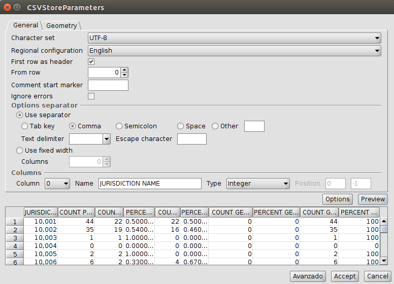
Why does row number show “0” in the spinbox, but start at 1 in the table?
…because it’s selected the option “First row as header”
Pingback: gvSIG 2.3 is now available! | gvSIG blog