
 There are a lot of applications of gvSIG in the field of natural hazards: flooding, fires… Recently a new one has been published about the evaluation of the amount of woods that can be transported by the flow during flooding events. This work has been partially developed within the Google Summer of Code 2014-2016 and presented during the 12th International gvSIG Conference in Valencia last December.
This application consists in a set of GIS-based tools developed in the JGrassTools spatial library and integrated as spatial toolbox in gvSIG. The user is guided through a step by step procedure starting from the raw data to the evaluation of the amount of wood available at any given section within a river basin.
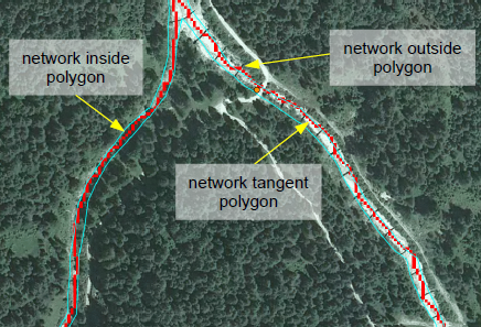
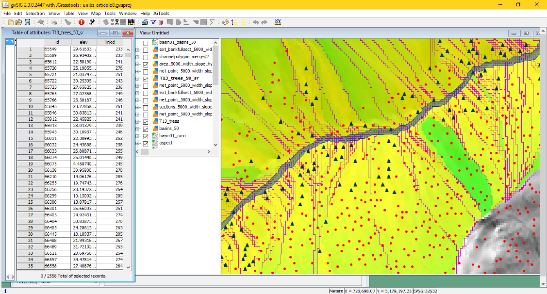 The models consider two main processes related to Large Wood (LW): recruitment and transportation. Regarding the recruitment process, the contributes of bank erosion and hillslopes shallow landslides are considered, while for the routing of the logs downstream the model uses simple Boolean transport conditions based on the ratio between the length of the logs and the width of the sections and the ratio between the diameter of the logs and the water depth. The hydraulic parameters are evaluated using the integrated 1D hydraulic model considering the input discharge and the geometries of the sections. The vegetation parameters can be derived from a detailed single tree extraction from LiDAR data or using information derived from the DSM and CHM.
Using gvSIG, the tools can be easily personalized by the user with local data and parameters in order to evaluate the magnitude of woody debris flooding and therefore identify the critical section for the transportation of large wood within a river basin and the amount of wood that can clog these sections.
Here you can see the video of this presentation:


