
At this penultimate module of the course about GIS for Archaeologists, you will see how to perform hydrological analysis from a Digital Elevation Model (DEM), that will be able to help to locate archaeological material.
If you haven’t done the previous exercises, we recommend you to start with the first module.
We remind you that the data to follow the course can be downloaded in a compressed .zip file from this link.
Remember that for doubts about software use, carrying out the exercises, and problems that you find when carrying out the course, you can use the gvSIG users mailing list.
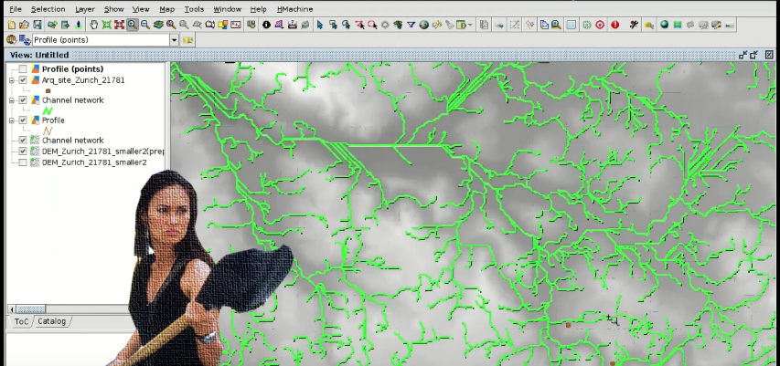
Module 6. Hydrological analysis to locate archaeological material or sites
Previous modules:
Module 1: Preparation of an archaeological project
Module 2: Digitalizing prospection areas
Module 3: Analysis of prospection results: Vector geoprocessing
Module 4: Working with historical maps: Georeferencing images


Hello, I have my doubts about the way that you think the mechanics of the pieces of ceramic or the deposition of this solids. I like more information about the logic behind use only a geoprocessing to create the stream and the relation with the archaeological record. Thanks.
Hello, that geoprocessing allows to know the possible location of other objects based on the flow from an archaeological site or from an area where other material was found. The approximated path that the water follows after raining indicates possible locations where they can be found.
Of course more geoprocessing can be applied, but it’s an introductory course, and with these tools we try to show how to work on this open source GIS in archaeology. From this course users can go in depth in new geoprocessing, and they know that DEM can be used for them.
Pingback: Hydrological analysis to locate archaeological material or sites. #GIS applied to Archeology – GeoNe.ws
Pingback: Graphical output of an archaeological project: Layouts. GIS applied to Archeology | gvSIG blog
Pingback: Free course about Geographic Information Systems applied to archaeology: Certification and links to the complete course | gvSIG blog