
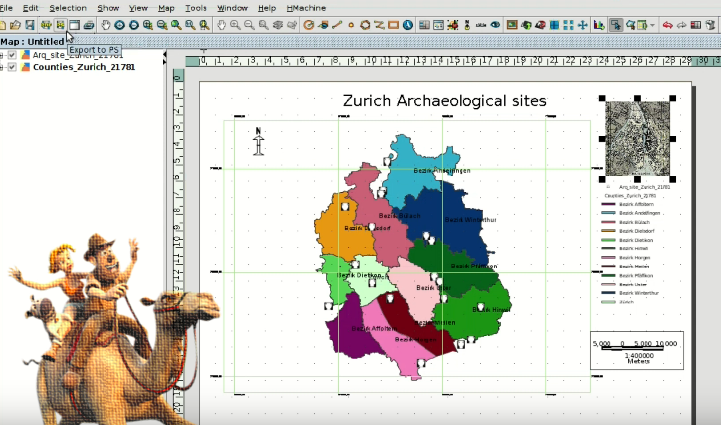
We have reached the end of the course about GIS for Archaeologists, where you are going to learn to create a Layout with the different cartographic elements such as scale, north, legend … For this you will start from a View of our GIS with archaeological sites cartography.
For all those who finish the course and want to get a certificate, we will publish a post with the instructions for it soon. Stay alert!
We remind you that the data to follow the course can be downloaded in a compressed .zip file from this link.
Remember that for doubts about software use, carrying out the exercises, and problems that you find when carrying out the course, you can use the gvSIG users mailing list.
We hope that this course is useful for you and that allows you to become a regular gvSIG Desktop user. From our part we will continue working to improve this great collaborative project that allows us to have hundreds of thousands of users in more than 160 countries.
Module 7. Graphical output of an archaeological project: Layouts
Previous modules:
Module 1: Preparation of an archaeological project
Module 2: Digitalizing prospection areas
Module 3: Analysis of prospection results: Vector geoprocessing
Module 4: Working with historical maps: Georeferencing images
Module 6: Hydrological analysis to locate archaeological material or sites


Pingback: Free course about Geographic Information Systems applied to archaeology: Certification and links to the complete course | gvSIG blog