
For the new gvSIG 2.5 version several parts have had to be redone to take advantage of the full potential of the gvSIG novelties right now. One of these parts that we have redone is the Column Manager.
The Column Manager is used for managing the layer scheme. We can add new fields, modify or delete them, as well as consult the characteristics associated with these fields.

New column manager. If the layer is not in editing mode, the “Modify” icon would be disabled.
Like always, the Column Manager can be accessed, once we have an attribute table opened, from its designated button at the toolbar or by going to the Table -> Column Manager menu. To access this manager now it will not be necessary to have the layer in editing mode. We can always access in query mode.
In the previous version, to modify characteristics of a field it was necessary to delete it and create it again. This will no longer be necessary. It will greatly facilitate the creation of complicated schemes because of being everything at the same window where it will be possible to add, modify and delete what we need.
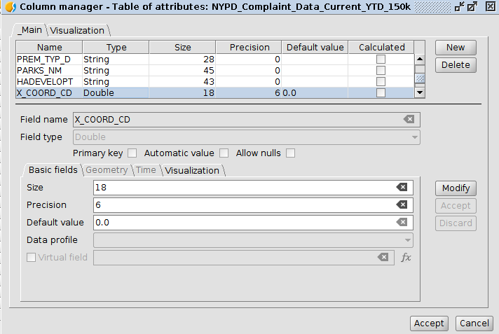
We can consult, for example, the parameters of a numerical type field with decimals (double). Fields appear such as size, precision, default value …
The advantage of this new manager, is that there are a lot of advanced options also integrated into it. For certain fields we can indicate several options such as not allowing nulls, a typical option in databases, but thanks to this new manager and other improvements made on gvSIG we can apply it in normal shapefiles. We will include more information about the use of advanced parameters in future manuals.
Another example is the “Data profile” field. It is an advanced option that allows to indicate that certain fields behave like another type of data. For example, fields with ByteArray type images are embedded in some SQLite layers. If we set that we want this ByteArray field to be recognized as an image in gvSIG, it will do it at that way and it will be shown as an image in different parts of the application, such as in the forms.
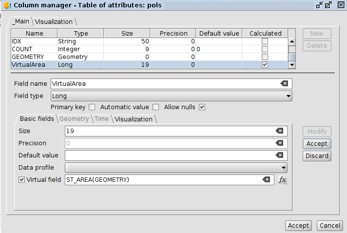
We also see that it includes the option to indicate that the field is a virtual field and its value corresponds according to an expression. We will dedicate an article and documentation especially for this type of fields. In this example we see that we have created a virtual field, at the bottom we can see the expression that will be used, and in the top it is marked as a calculated field.
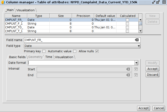
 In the date type fields we will see that the Time tab is enabled. In this tab it will be possible to set time ranges. These time ranges can be used to create animations of our data by time. These features were previously included in a separate extension, now all of them will be integrated into gvSIG.
 We also include another type of visualization tabs where a large number of parameters could be set to improve the visualization of the forms of this layer as well as for other type of advanced options that we will also show later.
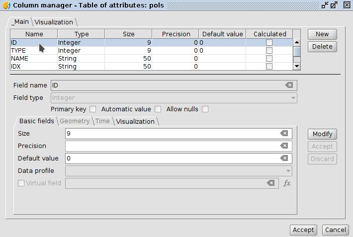
The mode of operation of the manager is very simple. If we want to modify a field, we select it, then we click on “Modify”, we change the desired fields and finally we accept again on the right side. If we want to add a field, we would press “New”, then at the bottom of the window we fill in the appropriate values, we accept, and finally we check that the field appears in the bottom of the list. To exit we would press “Accept” below. To delete a field, we would select it and then press “Delete”.
 This extra information that we add in some cases will be saved in a new file at the same folder of our layers. In the case of shapefiles, a file called *.dal will appear. That .dal file can only be read when it is loaded in gvSIG. If it is deleted we will not lose anything important, only some special parameters that we have established in the manager as well as the virtual fields that we have created. There is also support for other type of files that are not shapefiles, such as SQLite.
In summary, it is a tool where its possibilities have been greatly increased and which allows many options not included at the previous tool.


Pingback: Towards @gvSIG 2.5: New Column manager – GeoNe.ws
Pingback: gvSIG 2.5 RC2 is now available to download | gvSIG blog
Pingback: gvSIG Desktop 2.5 has arrived: Downloads are available now! | gvSIG blog