gvSIG Festival: Second Day [Videos]

gvSIG Online: the solution for Spatial Data Infrastructures on Open Source software (English) [César Martínez. Scolab. gvSIG Association]


Digital field mapping with Geopaparazzi and gvSIG (English) [Andrea Antonello. HydroloGIS. gvSIG Association]

Utilización del software gvSIG para el análisis acústico urbano: Sistema de Autopistas de La Ciudad Autónoma de Buenos Aires (Spanish) [Mario Fèvre. Trecc]


gvSIG Online: la solución para Infraestructuras de Datos Espaciales con software libre (Spanish) [César Martínez. Scolab. Asociación gvSIG][La parte final no se grabó por problemas técnicos/The end of the webinar wasn’t recorded because of technical problems]


Введение в gvSIG (Russian) [Alexander Karandeev]

And Today…

11:00-12:00

Scripting in gvSIG (English) [Óscar Martínez. gvSIG Association]

12:00-13:00

gvSIG Roads: gestión de la conservación e inventario de carreteras con software libre (Spanish) [Ricardo Rueda.DiSiD. gvSIG Association]

13:00-14:00

GIS tools for water supply systems: an implementation using Epanet and gvSIG (English) [Silvia Franceschi. HydroloGIS. gvSIG Association]

16:00-17:00

gvSIG Online: IDE para la Secretaría de Turismo de México (Spanish) [Juan José del Toro. GeoAlternativa]

17:00-18:00

Delimitación de Microcuencas hidrográficas con gvSIG (Spanish) [Roxana Sánchez. (Parque Tecnológico Itaipú-Paraguay)]

18:00-19:00

Sistema de Información Geografico Para Catrastro Municipal con Software Libre (Spanish) [Marino Carhuapoma. IdeasG]

* Madrid Time. Click on the time of every webinar to check it in your city.

** Registration is available clicking on the title of every webinar.

Posted in english, gvSIG Desktop, gvSIG Online, Russian, spanish | Tagged | Leave a comment

GIS of Thrones: Mapping Game of Thrones with gvSIG

Sometimes when we are doing training tasks, users ask us about free datasets to practice and learn all the possibilities that gvSIG gives us. Fortunately there are a great quantity of free data today, but it’s true that only a few times we find geographic information that allows us to enjoy while we learn to create legends, labeling, making geoprocesses…

We were thinking in it when we found a dataset, with free license, based on the successful series (in books and on TV) Game of Thrones. After testing it with gvSIG we found several errors at the information layers, but they were able to be solved easily with some geoprocesses. Since we were at that point, why don’t we play with symbology and labeling by scale?

Here you have a short video with the results:

And here you have a zip file with the data and the gvSIG project to be used. We know what project we are going to use to test the next version…

downloads.gvsig.org/download/documents/books/GISofThrones.zip

And another day we will speak about Star Wars…

Posted in gvSIG Desktop | 3 Comments

gvSIG Festival: First Day [Videos]

 Introduction to gvSIG (English) [Mario Carrera. gvSIG Association]

Utilización de gvSIG en estudios sobre desastres naturales y salud mental (Spanish) [Manuel Esteban Lucas Borja. Universidad de Castilla-La Mancha]

Utilização do gvSIG na Defesa Civil (Portuguese) [Gilberto Cugler. Comunidade gvSIG Brasil]

gvSIG applications in East Africa – Kenya and Somaliland (English) [Giuliano Ramat y Maurizio Fòdera]

O Futuro no Passado: o uso das geotecnologias aplicadas às pesquisas históricas (Portuguese) (Maíra Rosin. HIMACO]

And tomorrow…

11:00-12:00

gvSIG Online: the solution for Spatial Data Infrastructures on Open Source software (English) [César Martínez. Scolab. gvSIG Association]

12:00-13:00

Digital field mapping with Geopaparazzi and gvSIG (English) [Andrea Antonello. HydroloGIS. gvSIG Association]

13:00-14:00

gvSIG, un Système d’Information Géographique libre (French) [Victoria Agazzi. gvSIG Association]

16:00-17:00

Utilización del software gvSIG para el análisis acústico urbano: Sistema de Autopistas de La Ciudad Autónoma de Buenos Aires (Spanish) [Mario Fèvre. Trecc]

17:00-18:00

gvSIG Online: la solución para Infraestructuras de Datos Espaciales con software libre (Spanish) [José Vicente Higón. Scolab. Asociación gvSIG]

18:00-19:00

Delimitación de Microcuencas hidrográficas con gvSIG (Spanish) [Roxana Sánchez. (Parque Tecnológico Itaipú-Paraguay)]

19:00-20:00

Введение в gvSIG (Russian) [Alexander Karandeev]

* Madrid Time. Click on the time of every webinar to check it in your city.

** Registration is available clicking on the title of every webinar.

Posted in english, events, portuguese, Russian, spanish | Tagged | 1 Comment

GIS of Thrones: Mapeando Juego de Tronos con gvSIG

En muchas ocasiones, cuando realizamos tareas de formación, nos preguntan por juegos de datos libres para poder practicar e ir aprendiendo todas las posibilidades que nos da gvSIG. Afortunadamente hoy hay una cantidad inmensa de datos libres, pero también es cierto que pocas veces se encuentra información geográfica que nos permita divertirnos un poco mientras aprendemos a crear leyendas, etiquetados, realizar geoprocesos…

Andaba pensando en esto cuando encontré un juego de datos, con licencia libre, basado en la exitosa serie (de libros y de TV) Juego de Tronos. Tras revisarlo con gvSIG encontré unos cuantos errores en las capas de información, pero que mediante unos pocos geoprocesos se solucionaban con facilidad. Ya que estaba, ¿por qué no jugar un poco con la simbología y el etiquetado por escalas?

Os dejo un pequeño vídeo del resultado:

Y aquí tenéis un zip con los datos y el proyecto de gvSIG listo para ser utilizado. Ya sé con que proyecto voy a comenzar a testear la próxima versión de gvSIG…

downloads.gvsig.org/download/documents/books/GISofThrones.zip

Y otro día hablaremos de Star Wars…

Posted in gvSIG Desktop, spanish, training | 4 Comments

gvSIG Festival: webinars in English

adictos-redes-sociales
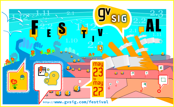
As you know, the 1st gvSIG Festival will be held from May 23rd to 27th.

At this post we are going to summarize the webinars that will be given in English. For registrations you only have to press on the title of the webinar.

On Monday, May 23rd, we will start with a webinar about Introduction to gvSIG. The main characteristics about the gvSIG project will be shown at this webinar, as well as several videos about the main functionalities of gvSIG Desktop.

At the same day, Giuliano Ramat and Maurizio Fòdera will speak about gvSIG applications in East Africa – Kenya and Somaliland.  This presentation concerns two projects in east Africa where it has been offered a similar approach adapting the proposal to the different needs of the partners. The main goal was to provide local partner and authorities with a GIS product easy to use and update regularly; fully developed with open source technology to ensure future sustainability; replicated in other main similar neighbouring environments and, especially for urban cadaster, is able to provide a precise measurement of interesting targets.

On Tuesday there will be two webinars in English. At the first one, César Martínex (Scolab. gvSIG Association) will present one of the last products of the gvSIG Association, gvSIG Online, the alternative to ArcXXX Online, with the presentation gvSIG Online: the solution for Spatial Data Infrastructures on Open Source software.

The second one will deal with Digital field mapping with Geopaparazzi and gvSIG, given by Andrea Antonello, from Italy (HydroloGIS. gvSIG Association). Geopaparazzi is an application for fast field surveys. Its simplicity and the possibility to use it on as good as any android smartphone makes it a trusty field companion for engineers and geologists, but also for tourists who wish to keep a geodiary and any user that needs to be aware of his position even in offline mode. The plugin for Geopaparazzi in gvSIG supplies a userfriendly GUI with GIS functionalities to visualize all the data collected in the field, GPS tracks, text notes, pictures and form based notes and gives the possibility to save them as shapefiles.

The scripting module will be shown at the first presentation on Wednesday: Scripting in gvSIG, given by Óscar Martínez, from the gvSIG Association. Here you can discover all the possibilities that gvSIG 2.3 offers!!

At the same day, Silvia Franceschi, from HydroloGIS (Italy) and gvSIG Association, will give another interesting presentation in English, about GIS tools for water supply systems: an implementation using Epanet and gvSIG, tools that can be used by professionals and public administrations to design and verify water supply systems.

On Thursday there will be a presentation from India. Gowtham Gollapalli, from KAIINOS company, will speak about Evaluating temporal changes to water bodies in Medak India. In this presentation the presenters will analyze the effect of change in water spread on the population of Medak district, in India.

The next presentation at that day will deal with New tools for LiDAR, forestry, river management and hydro-geomorphology with jGrassTools in gvSIG. Andrea Antonello and Silvia Franceschi will speak about this issue.

And finally, at the last day of the gvSIG Festival, Manuel Madrid will present Monitoring Global Urban Expansion: Assessing the quality of urban layouts. This webinar will show the basis of a methodology developed by the New York University (NYU) and the gvSIG Association for assessing urban layouts, which is based on digitization on high resolution satellite imagery and on the use of open source software.

The webinar platform allows to connect to the webinars from any operating system, and in case you can’t see some of the webinars, you will be able to watch them at the gvSIG Youtube channel later.

See you at the gvSIG Festival!

Posted in community, english, events | Leave a comment

TIC: Cero despedidos por meter la pata con las grandes

Una figura relevante en muchas organizaciones con una fuerte componente TIC, tanto públicas como privadas, era la del responsable de echarse en brazos de grandes contratos de soporte del tipo “GoldenSelectConfort” y mil maravillas más que auguraban un maravilloso futuro de vino y rosas.

Esto ocurría sobre todo en tiempos de una figurada bonanza económica. Sin embargo, ¿Qué pasó cuando esta desapareció? ¿Qué ocurrió con los contratos que les ataban a tal gestor de Base de Datos, Solución de Gestión empresarial, transversal de Geomática, etc?

Te encontrabas con contratos millonarios, condiciones de soporte y compromiso de mantenimiento en el tiempo leoninas, proyectos fiasco, nula sostenibilidad. En definitiva, atados de pies y manos, y es que, resulta que eso de la Soberanía en los Sectores Estratégicos, como que no nos lo tomamos muy en serio.

Dibujaban muy bonitos esos días de Vino y Rosas, pero hemos de recordar que sucede en la maravillosa película de Jack Lemmon y Lee Remick dirigida por Blake Edwards. [1] Aquí una de sus memorables escenas. [2]

El autodestructivo alcoholismo se convierte en el caso de que estamos hablando en insostenilibidad, recortes, expedientes de regulación de empleo o cierres.

Sucede que por mi desmemoria no me viene a la mente ningún de estos laureados responsables que haya sido cesado por meter la pata en dichas ruinosas, faraónicas e insostenibles apuestas. Pon un Golden o Platinum acompañado de una de estas grandes firmas ¿Y quién te va a culpar de hacer lo que te indica el mercado y todas sus consultoras y libros blancos?

Ahora imaginen a cualquiera de estos gerentes tomando una decisión en alguna de sus áreas donde la apuesta sea una Solución Libre. Imaginen que los resultados no sean los perfectos. Empiecen a visualizar como le aprieta el cuello de la camisa, como empieza a sudar, como empieza a temer que le peligra el puesto por no haber seguido lo que todos. Pon un Golden en tu vida y firma, que aunque resulte un fiasco, ¿Quién te va culpar de hacer lo que todos tus colegas?

Quizá ese sea uno de los problemas. Las cero responsabilidades exigidas a los gerentes TIC cuando los fiascos vienen avalados por el respaldo de las grandes firmas privativas; pero el temor a equivocarse lo más mínimo cuando la apuesta es por las soluciones libres.

Quizá un cambio cultural sea necesario antes de consolidar realidades de Interoperabilidad y Soberanía Tecnológica.

Quizá los representantes públicos, sobre todo aquellos que hablan del cambio de modelo productivo, deberían ser consecuentes y favorecer dicha transformación cultural.

@GabrielCarrionR

[1] https://es.wikipedia.org/wiki/D%C3%ADas_de_vino_y_rosas

[2] https://www.youtube.com/watch?v=Yip1jxoIEyA

Posted in gvSIG Desktop, Languages, opinion, spanish | Leave a comment

gvSIG Festival: webinars en español

adictos-redes-sociales

Como ya sabréis la semana del 23 al 27 de mayo se celebra el 1er gvSIG Festival. En este post quiero hacer un breve repaso a las ponencias que se realizarán en español. El programa completo, con horarios y ponencias en todos los idiomas, lo tenéis en la web del evento: http://gvsig.com/festival

Para inscribiros en un webinar en concreto podéis pinchar sobre su título, en este mismo post o hacerlo desde la web del evento.

El lunes tendremos la primera ponencia en español, combinando las disciplinas de la geomática y la psiquiatría, Utilización de gvSIG en estudios sobre desastres naturales y salud mental por Manuel Esteban Lucas Borja de la Universidad de Castilla-La Mancha.

El martes 24 de mayo tendremos tres ponencias. Desde Argentina, Mario Fèvre de Trecc nos presentará la Utilización del software gvSIG para el análisis acústico urbano: Sistema de Autopistas de La Ciudad Autónoma de Buenos Aires, José Vicente Higón de Scolab, una de las empresas de la Asociación gvSIG nos presentará la alternativa libre a ArcXXX Online gvSIG Online: la solución para Infraestructuras de Datos Espaciales con software libre y finalizaremos con la ponencia de Roxana Sánchez, del Parque Tecnológico Itaipú-Paraguay, centrada en el campo de la hidrología Delimitación de Microcuencas hidrográficas con gvSIG.

El tercer día del gvSIG Festival, Ricardo Rueda de Disid, otra de las empresas de la Asociación gvSIG, nos hablará sobre la única aplicación libre existente para gestión de carreteras y la única cuyo modelo de datos de ejes carretera cumple con la normativa INSPIRE de obligado cumplimiento en 2017 gvSIG Roads: gestión de la conservación e inventario de carreteras con software libre. Desde México, Juan José del Toro de Geoalternativa y Responsable de Operaciones México y Caribe de la Asociación gvSIG, nos mostrará los resultados de la implantación de gvSIG Online en SECTUR gvSIG Online: IDE para la Secretaría de Turismo de México. Marino Carhuapoma de IdeasG, empresa colaboradora de la Asociación gvSIG en Perú nos presentará uno de los productos que han desarrollado y que cada vez adoptan más municipios en Perú Sistema de Información Geografico Para Catrastro Municipal con Software Libre.

El jueves comenzaremos con una ponencia sobre las posibilidades de Geoprocesamiento con gvSIG impartida por Gustavo Agüero, de la empresa Consultores AA de Costa Rica. Si estáis interesados en conocer las novedades de la próxima versión de gvSIG no os podéis perder la presentación Novedades gvSIG 2.3: ¿En qué estamos trabajando?. Para finalizar, Sergio Acosta del Ministerio de Topografía y Obras Públicas de Uruguay nos hablará del Programa de Caminería Rural en Uruguay con gvSIG.

Llegamos al viernes 27 de mayo, último día de jornadas, con la ponencia impartida por Valeria Sanguineti de ONG2.0 ONG2.0 formación en gvSIG e ICT4D para proyectos de cooperación internacional.

Un buen número de webinars en castellano, a cual más interesante. Nadie se lo va a querer perder…

Posted in community, events, spanish | Tagged , | Leave a comment

Вебинар «Введение в gvSIG» на 1-м фестивале gvSIG

С 23 по 27 мая Ассоциация gvSIG проводит 1-й фестиваль gvSIG, в рамках которого пройдет целая серия онлайновых мероприятий.

festival portada v03Основу программы составят вебинары, список которых представлен на странице фестиваля http://www.gvsig.com/en/events/gvsig-festival/1st-gvsig-festival/program

Российское сообщество gvSIG также примет участие в фестивале с вебинаром  «Введение в gvSIG», который состоится 24 мая (вторник) в 20-00 МСК.

Вебинар будет посвящен новостям проекта gvSIG, новым продуктам Ассоциации gvSIG, а также новым возможностям и изменениям в gvSIG Desktop. Вебинар продлится около 40-60 минут и будет проводится на русском языке.

Проведет вебинар Александр Юрьевич Карандеев, старший преподаватель кафедры географии и экологии, Липецкий государственный педагогический университет. Также в подготовке вебинара принимал участие Сергей Анатольевич Михайлов, начальник отдела ГИС, ООО «Геоинфоцентр».

Для участия в вебинаре можно зарегистрироваться по прямой ссылка на регистрацию в вебинаре http://app.webinarjam.net/register/24718/ed6eb0efb2

Задавать вопросы и высказывать пожелания можно в комментариях в блоге gvSIG или в сообществе в сети «ВКонтакте» https://vk.com/club27058823

Posted in community, events, Russian | Leave a comment

Free registration for gvSIG festival is now open

festival portada v03Free registrarion period for the 1st gvSIG Festival is now open, a virtual conference about free geomatics with more than 25 presentations in English, Spanish, French, Portuguese, Turkish and Russian.

At this first edition there will be presentations about the different gvSIG products (Desktop, Online, Roads…) and how they can be applied in different themes like mental health, civil protection, cooperation, historic studies, roads management, acoustic analysis, hydrology, tourism, urban analysis…

The webinar platform allows to connect to the webinars from any operating system, and in case you can’t see some of the webinars, you will be able to watch them at the gvSIG Youtube channel later.

Registration for each webinar can be done from the gvSIG Festival website.

See you at the gvSIG Festival!

Posted in community, english, events | Leave a comment

Abiertas las inscripciones gratuitas para el gvSIG Festival

festival portada v03Ya están abiertas las inscripciones gratuitas para el 1er gvSIG Festival, unas jornadas virtuales sobre geomática libre con más de 25 webinars en Español, Francés, Inglés, Portugués, Ruso y Turco.

En esta primera edición se presentarán distintas experiencias sobre los diferentes productos gvSIG (Desktop, Online, Roads…), y cómo se pueden aplicar a temas tan variados como la salud mental, protección civil, cooperación, estudios históricos, gestión de carreteras, análisis acústico, hidrología, turismo, análisis urbanos…

La plataforma de webinar permite conectarse desde cualquier sistema operativo, y en caso de no poder seguirlos en directo podréis verlos a posteriori, ya que se publicarán en el canal de Youtube del proyecto.

La inscripción a cada uno de los webinars puede realizarse desde la web del evento.

¡Os esperamos!

Posted in community, events, spanish | Leave a comment