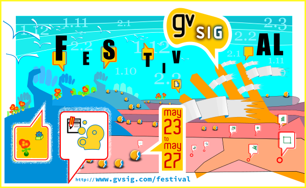
Free registrarion period for the 1st gvSIG Festival is now open, a virtual conference about free geomatics with more than 25 presentations in English, Spanish, French, Portuguese, Turkish and Russian.
At this first edition there will be presentations about the different gvSIG products (Desktop, Online, Roads…) and how they can be applied in different themes like mental health, civil protection, cooperation, historic studies, roads management, acoustic analysis, hydrology, tourism, urban analysis…
The webinar platform allows to connect to the webinars from any operating system, and in case you can’t see some of the webinars, you will be able to watch them at the gvSIG Youtube channel later.
Ya están abiertas las inscripciones gratuitas para el 1er gvSIG Festival, unas jornadas virtuales sobre geomática libre con más de 25 webinars en Español, Francés, Inglés, Portugués, Ruso y Turco.
En esta primera edición se presentarán distintas experiencias sobre los diferentes productos gvSIG (Desktop, Online, Roads…), y cómo se pueden aplicar a temas tan variados como la salud mental, protección civil, cooperación, estudios históricos, gestión de carreteras, análisis acústico, hidrología, turismo, análisis urbanos…
La plataforma de webinar permite conectarse desde cualquier sistema operativo, y en caso de no poder seguirlos en directo podréis verlos a posteriori, ya que se publicarán en el canal de Youtube del proyecto.
La inscripción a cada uno de los webinars puede realizarse desde la web del evento.
If you need to learn about gvSIG through a complete and didactics series of videos… you are lucky.
At this post I wanted to reffer to the EdugvSIG Youtube channel, created by Jesús Palomar Vázquez and Merche Navarro, from the Department of Cartographic, Geodetic Engineering and Photogrammetry at the Polytechnic University of Valencia. It is a channel dedicated to show, step by step, through practical exercises, the main functionalities of gvSIG.
All the videos have Spanish audio and they are subtitled in English as well as in Spanish.
Besides dozens of videos, the data to do the exercises are available too. These data can be downloaded from here.
Si necesitas aprender gvSIG mediante una serie muy completa y didáctica de vídeos explicativos…estás de suerte.
En este post quería hacer referencia al canal de YouTube EdugvSIG, creado por Jesús Palomar Vázquez y Merche Navarro del Departamento de Ingeniería Cartográfica, Geodesia y Fotogrametría de la Universidad Politécnica de Valencia. Es un canal dedicado a mostrar, paso a paso, mediante ejercicios prácticos, las principales funcionalidades de gvSIG.
Todos los vídeos tienen audio en castellano y están subtitulados tanto al inglés como al castellano.
Además de una treintena de vídeos, están disponibles los datos utilizados para realizar cada uno de los ejercicios. Estos datos se pueden descargar pinchando aquí.
A continuación el listado de vídeo-tutoriales disponibles:
Una de las más bien recibidas mejoras en el Módulo de Scripting durante los últimos meses, fue el desarrollo realizado para la creación de scripts con interfaz visual.
Siempre se han podido realizar scripts con una interfaz visual, es algo vital para la interacción del usuario con nuestro programa, pero nunca había sido tan sencillo. La forma de realizarlo anteriormente era excesivamente complicada, se perdía mucho tiempo y no cumplía siempre su propósito.
El desarrollo actual que se ha realizado es el de dar soporte a las interfaces creadas con un programa conocido como Abeille.
Ejemplo de interfaz incluyendo una imagen
Este programa es muy sencillo de usar, cualquiera puede aprender a manejarlo rápidamente. Corresponde a una cuadrícula en la cual vamos situando los elementos que necesitamos, definiendo sus características y dándoles nombre. Solo quedará guardarlos con extensión .xml y gvSIG podrá usarlos en nuestros scripts.
Programa Abeille
El uso de este programa lo introdujimos en las 11as Jornadas de gvSIG, podéis ver el video aquí (8m15segs y mucho más sobre cómo programar usándolo):
Pero las mejoras no se quedan ahí, se ha desarrollado una librería para que cargar nuestra interfaz sea posible con un par de líneas.
from gvsig import *
from libs.formpanel import FormPanel

class Panel(FormPanel):
    def __init__(self):
        FormPanel.__init__(self, script.getResource("ui_basic.xml"))

    def btnCalcular_click(self, *args):
        self.txtField.setText("Clicked!")
        print "Clicked!"

    def btnClose_click(self,*args):
        self.hide()

def main(*args):
  l = Panel()
  l.showTool("Visual")
  pass
Además se ha facilitado mucho la interacción entre nuestro script y esta interfaz visual, dando soporte tanto para los click de ratón sobre los elementos como botones, así como listeners para realizar acciones cuando estos elementos de la interfaz cambien de una cierta manera.
La librería se encarga de todo, tu solo tendrás que programar las funciones necesarias. Por ejemplo: miboton_click() definirá las acciones que se realizarán al presionar “miboton“. En la imagen podemos ver como btnCalcular modificará el cuadro de texto txtField al hacer un click además de mostrar un texto por consola.
Interfaz visual ya ejecutada a través de nuestro script en gvSIG
Podemos insertar componentes visuales ya existentes en gvSIG que estén siendo utilizados en otras partes del programa, como por ejemplo:
También se irán añadiendo funciones que nos sean útiles para, por ejemplo, cargar las Vistas o Capas de nuestro proyecto en un menú desplegable (combobox), en un menú de tipo árbol, etc.
Estás librerías y herramientas van ya todas incluidas de serie a partir de la versión de gvSIG 2.3, facilitando al máximo para los que queráis poneros a programar.
Si estás interesado en desarrollar para la versión 2.2 de gvSIG, las herramientas deberían de funcionar correctamente (la mayoría al menos) solo que la instalación de ellas y algunos trozos de código serían diferentes. Podéis hacérnoslo saber por aquí o por las listas de correo, realizaremos comprobaciones de que todo funcione correctamente en esa versión 2.2, y realizaremos un pequeño manual o post con todo lo necesario.
El desarrollador principal de gvSIG, Joaquín del Cerro, sigue actualmente haciendo mejoras en estos apartados, así que tal vez tengamos alguna novedad más.
Espero que os interese este post, y que así podáis ver mejor la potencia que tiene el poder realizar scripts en gvSIG con el extra de dotarles de una interfaz visual de una forma tan sencilla, restando increíblemente el tiempo de desarrollo, para poder centrarnos en lo que realmente queramos hacer.
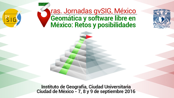
Del 7 al 9 de septiembre de 2016 se van a celebrar las 3as Jornadas gvSIG México, bajo el lema “Geomática y software libre en México: Retos y posibilidades”.
Las jornadas tendrán lugar en el Instituto de Geografía de la Ciudad Universitaria, en Ciudad de México, y para las mismas se ha abierto ya el periodo para el envío de propuestas para comunicaciones. Desde hoy pueden enviarse las propuestas a la dirección de correo electrónico 3asjornadasgvsig@igg.unam.mx. Toda la información sobre las normas para la presentación de comunicaciones puede consultarse en el apartado de Comunicaciones de la web.
Igualmente, el próximo día 11 de julio se abrirá el periodo de inscripción, que al igual que en años anteriores será gratuita.
One of the first projects of the gvSIG Association, it was the launch of the city transport company´s geo-portal (EMT) in Valencia. It’s been over five years since its start-up and remains the reference website to see how to get from one place to another city using different means of transportation:: subway, bus, bicycle, Valenbisi (public service of bike renting) or by foot.
All developments were made without spending a euro in licenses, using open source software exclusively and despite the time that has already passed, it´s still one of the most comprehensive route planners about urban transport that can be found. One more example of why the gvSIG Association has become an international benchmark in the open source geomatics.
Through this geoportal we can calculate any route, indicating the means of transport that we use and we inform several possible routes, allowing evaluate each of them and select the most suitable for the user. Among the route details, even it´s is possible to calculate the savings of CO2 emissions that cause the greenhouse effect (compared with the number of trees that would be needed to save that amount of CO2 in a day) for performing the same route with a private car.
Besides the tools directly related to route calculation, the user finds a number of utilities: discover which elements of interest there are about a point, consult routes and timetables for each bus line, display by categories points of interest, print route plans…
Here you have three videos showing how the app works…. but the best you can do it´s to try it when you come to Valencia (for example for the next gvSIG International Conference). Then you can use it and discover all the utilities of this app (http://www.emtvalencia.es/geoportal/?lang=en_otp).
If this is what we did in our beginnings… imagine what can we do now.
If you are interested in implementing these kind of solutions in your organization, contact us: info@gvsig.com. Besides having the best experts in free geomatics, you will be helping the maintenance and development of the gvSIG technology.
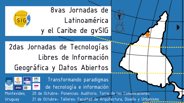
Los días 20 y 21 de octubre de 2016 se celebrarán las 8as Jornadas de Latinoamérica y Caribe de gvSIG en Montevideo (Uruguay), bajo el lema “Transformando paradigmas de tecnología e información”.
Ya está abierto el periodo para el envío de propuestas para comunicaciones para las Jornadas. Desde hoy pueden enviarse las propuestas a la dirección de correo electrónico jornadas.latinoamericanas@gvsig.org, que serán valoradas por el comité científico de cara a su inclusión en el programa de las Jornadas. Toda la información sobre las normas para la presentación de comunicaciones puede consultarse en el apartado de Comunicaciones de la web. El periodo de recepción de resúmenes finalizará el próximo 2 de septiembre.
El próximo día 22 de agosto se abrirá el periodo de inscripción. La inscripción a estas jornadas es gratuita.

 Free registrarion period for the 1st gvSIG Festival is now open, a virtual conference about free geomatics with more than 25 presentations in English, Spanish, French, Portuguese, Turkish and Russian.