
In gvSIG 2.3 users will be able to access a new source of data that has been using more and more, the LiDAR data. gvSIG 2.3 drivers provide to read and write LiDAR in gvSIG according to LAS specification. A cropping tool will be also provided to export a subset of LIDAR data.
Drivers
User will have two options for working with LAS files, based on gvSIG implementation of two different libraries, each one with its advantages:
-
JGrasstools based provider that is read / write.
-
Whitebox based that is read-only provider, but currently offers better performance than the one based on Jgrasstools.
Clarified/simplification
Both drivers include two parameters “clarified” (simplification), which let you read a subset of the total points available in the LAS file. Simplification allows quickly draw huge files at small scales (where a level of detail as high as that provides the file is not required):
-
ThinningDivisor: reads 1 point out of n items (1 / n), for example when thinningDivisor = 10 it loads 10% of the total available points
-
ThinningResolution: load approximately n dots per square unit of the layer; for example, if thinningResolution = 0.0001 means that it loads 0.0001 points / m2 (assuming that in this case layer projection units are meters), or that is the same, 100 points / km²
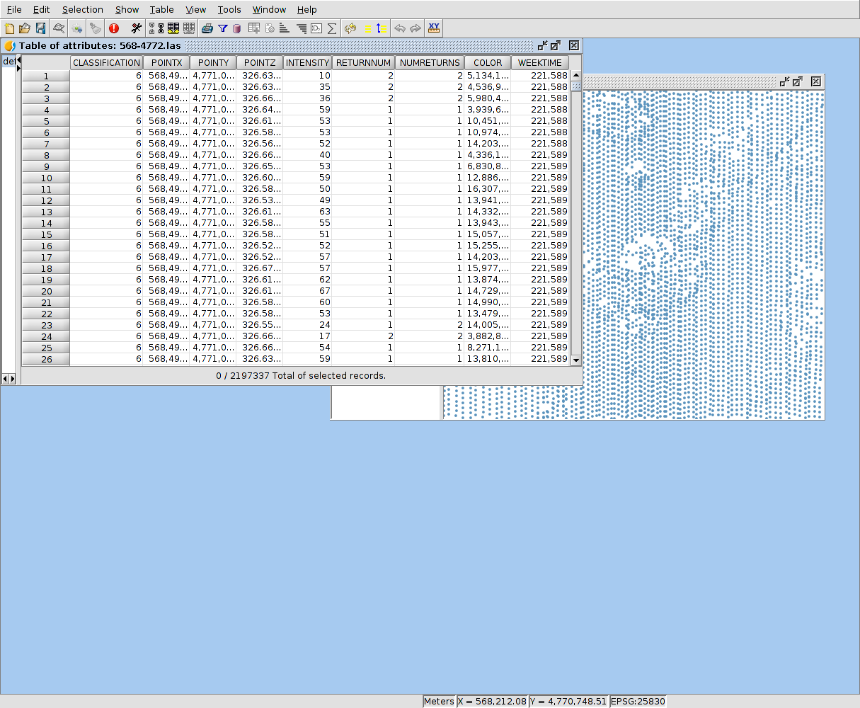
Attributes
LAS files have a set of mandatory fields (fixed) and other optional depending on point data format as specified in the LAS file header.
Mandatory fields are:
- CLASSIFICATION (land cover)
- POINTX (x coordinate of the point)
- POINTY (coordinate of the point)
- POINTZ (z coordinate of the point, useful to symbolize elevations)
- INTENSITY (intensity)
- RETURNNUM (point return number)
- NUMBEROFRETURNS (number of returns for this laser pulse)
Optional fields are:
- COLOR (color point, expressed as a whole “long” Java containing the RGB value)
- TIME (absolute time capture, expressed as generated by Data.getTime ())
- WEEKTIME (relative time capture, expressed as a weekly GPS time)
Export tool
Cropping tool allows you to choose a data subset to be exported to a new LAS file.
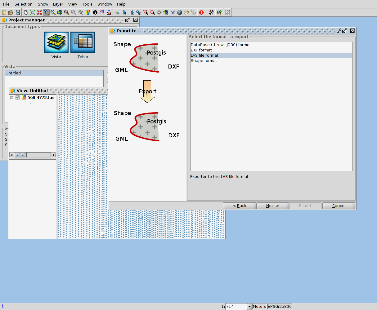
The tool lets you choose a geographic extension to filter the data (only points that fall within the selected geographic extension will be exported). The possible options are:
-
No filter by geometric extension
-
Filter data using extension visible in the active view.
-
Filter using a geometric extension specified by the user.
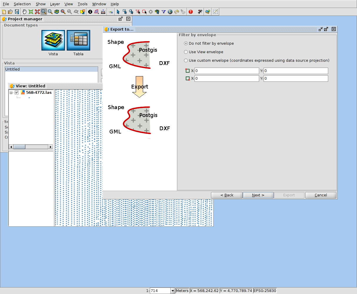
It is important to note that if users load the layer in the view using data options “clarified” (simplification), the export tool will act according to these options, exporting only the simplified version of the data.
To make this topic easier to understand, you can watch a couple of videos related to the LiDAR data management in gvSIG.


Pingback: gvSIG 2.3 is now available! | gvSIG blog