The deadline for submitting communication proposals for 16th International gvSIG Conference (online event this year), has been extended. The new deadline is October 6th.
Being a virtual event, any person or organization will be able to present their project about gvSIG from anywhere in the world, just needing internet connection. All the information about proposals sending is indicated at Communications section of the event website. English and Spanish proposals are accepted.
Registrations will be free of cost and they will be able to be done once the program is published.
El plazo de envío de resúmenes para las 16as Jornadas Internacionales gvSIG, que este año serán de forma online del 4 al 6 de noviembre, ha sido ampliado unos días, siendo la nueva fecha límite el día 6 de octubre.
Al ser unas jornadas virtuales cualquier persona u organización puede presentar su proyecto sobre gvSIG desde cualquier parte del mundo, necesitando únicamente una conexión a internet, con lo que os animamos a presentar vuestras propuestas. Toda la información sobre el envío de comunicaciones podéis encontrarla en la web del evento. Se pueden enviar propuestas en español e inglés.
La inscripción a las jornadas será gratuita, y podrá realizarse una vez publicado el programa de las mismas.
In the latest version of gvSIG Online, it’s possible to create custom geocoders from our own SHP layers. It allows to include place names that do not appear in the most common geocoders such as Nominatim or Google by default, such as local elements, or place names in other languages.
In the case of having two or more official languages in a region or country, and when the aforementioned geocoders do not include the place names of any of them, we could, for example, load our local street map with the place names in that language.
The steps to create a geocoder are as simple as uploading the SHP file to the platform, exporting it to the database, and creating the geocoder from it.
Thus, when searching for a place name in any of the projects, it would already show us the results of that layer.
En la última versión de gvSIG Online se ha incorporado la posibilidad de crear geocodificadores personalizados a partir de capas SHP propias. Esto permite incluir topónimos que por defecto no aparecen en los geocodificadores más comunes como Nominatim o Google, como pueden ser elementos locales, o topónimos en otros idiomas.
En el caso de disponer de dos o más lenguas oficiales en una región o país, y de que los geocodificadores mencionados no incluyesen los topónimos de alguna de ellas, podríamos cargar por ejemplo nuestro callejero local con los topónimos en dicha lengua.
Los pasos para crear un geocodificador son tan sencillos como subir el fichero SHP a la plataforma, exportarlo a la base de datos, y crear el geocodificador a partir de ella.
De esa forma, al realizar la búsqueda de un topónimo en cualquiera de los proyectos, ya nos mostraría los resultados de esa capa.
Una funcionalidad muy utilizada en algunos sectores como el de medio ambiente o la topografía es la de calcular perfiles de elevaciones, una herramienta que se ha incluido en la última versión de gvSIG Online, gracias al proyecto de la IDE de Uruguay.
Con esta herramienta, dibujando un perfil longitudinal sobre el geoportal, al finalizar dicha polilínea (que puede estar formada por varios segmentos) se calcula el perfil de elevaciones a partir del Modelo Digital de Terreno incluido, y se muestra la gráfica, que puede guardarse como imagen para insertar por ejemplo en una presentación o informe.
A widely used functionality in some sectors such as environment or topography is that which allows to calculate elevation profiles, a tool that has been included in the latest version of gvSIG Online, thanks to the Uruguay SDI project.
With this tool, when drawing a longitudinal profile on the geoportal, and finishing that polyline (which can be made up of several segments) the elevation profile is calculated from the included Digital Elevation Model, and the graph is shown, which can be saved as image to be inserted in a presentation or report.
A very interesting tool included at gvSIG Online in its latest version, which makes elements searching easier for non-technical users, is the quick filter.
Until the previous version, if a user wanted to search a specific municipality, a river, etc., or the elements that meet a numerical condition (for example, municipalities with more than a specific number of inhabitants), they should open the attribute table, perform a search (which in the first case mentioned could be done directly by typing the place name in the table’s quick filter, but in the second case the advanced filter available within the attribute table should be used, which might not be easy for non-technical users), and with the results obtained, select them and zoom the selection.
With the new quick filter, available directly from the Table of Contents, through the new added tab, the user will be able to select the group of layers, the layer, the field of the table for the filter, and the value to filter. And in the case of numeric fields, user can select the “greater than” and less than” operators, and manually enter a number, allowing them to search elements that meet a certain condition in a simple way.
Una novedad muy interesante que incluye gvSIG Online en su última versión es el filtro rápido, que facilita a los usuarios no técnicos la búsqueda de elementos en un proyecto.
Hasta la versión anterior, si un usuario quería buscar un municipio concreto, un río, etc., o los elementos que cumpliesen una condición numérica (por ejemplo los municipios con más de un número concreto de habitantes), debía abrir la tabla de atributos, realizar una búsqueda (que en el primer caso mencionado se podía hacer directamente escribiendo el topónimo en el filtro rápido de la tabla, pero en el segundo caso se debía utilizar el filtro avanzado disponible dentro de la tabla de atributos, lo que podía no ser sencillo para usuarios no técnicos), y con los resultados obtenidos seleccionarlos y hacer un zoom a la selección.
Con el nuevo filtro rápido, directamente desde la Tabla de contenidos, a través de la nueva pestaña añadida, el usuario podrá seleccionar el grupo de capas, la capa, el campo de la tabla por el cual filtrar, y el valor a filtrar. Y en el caso de campos numéricos, se podrá seleccionar los operadores “mayor que” y menor que”, y escribir manualmente un número, con lo que permite buscar elementos que cumplan una determinada condición de una forma sencilla.
En este vídeo se puede ver mejor su funcionamiento:
Para los interesados, este viernes se impartirá la charla “La importancia de la Geografía, la geomática y la soberanía tecnológica. La solución gvSIG”, organizada por el Colegio de Ingenieros Geógrafos de Bolivia.
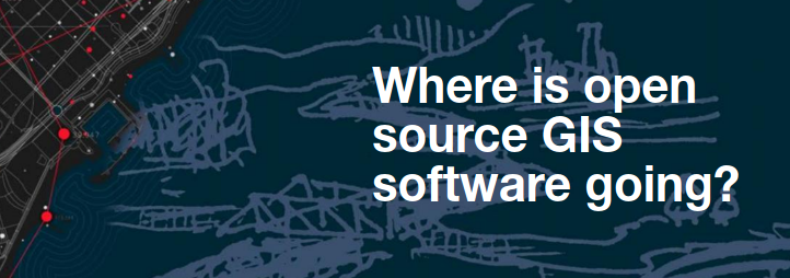
TWINGEO magazine asked us for an article that answered the question “Where is open source GIS software going?”
At a technical level, the software applied to geographic information management will follow similar dynamics, regardless of its license. It must be remembered that the “open” concept applies to the conditions of use of a software, the rights that are granted to the user, regardless of their capabilities or technological focus. Therefore, from our perspective, “Where is open source GIS software going to” question must have different answers depending on the approach we have to it. We will focus on two main points of view: technology and industry.