Salida gráfica de un proyecto arqueológico: Mapas. SIG aplicados a Arqueología

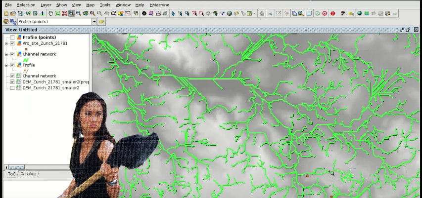
Llegamos al final del curso de SIG aplicado a arqueología, donde aprenderemos a crear un Mapa con los distintos elementos cartográficos como escala, norte, leyenda…Para ello partiremos de una Vista de nuestro SIG con cartografía de yacimientos.

Para todos los que acabéis el curso y queráis obtener un certificado, en breve publicaremos un post con las instrucciones para ello. ¡Estad atentos! Continue reading

Posted in gvSIG Desktop, software libre, spanish | Tagged , , , , , | 1 Comment

Hydrological analysis to locate archaeological material or sites. GIS applied to Archeology


At this penultimate module of the course about GIS for Archaeologists, you will see how to perform hydrological analysis from a Digital Elevation Model (DEM), that will be able to help to locate archaeological material. Continue reading

Posted in english, gvSIG Desktop, training | Tagged , , , , , | 5 Comments

Análisis hidrológico para localizar materiales o yacimientos arqueológicos. SIG aplicados a Arqueología

En este penúltimo módulo del curso de SIG aplicado a arqueología, veremos como a partir de un Modelo Digital de Terreno (MDT) podemos realizar varios análisis hidrológicos que nos servirán para localizar material arqueológico. Continue reading

Posted in gvSIG Desktop, software libre, spanish | Tagged , , , , , , , , | 2 Comments

Territorial analysis of archaeological sites: Raster geoprocessing and Digital Elevation Models. GIS applied to Archeology

We are now reaching the end of the course about GIS applied to Archaeology. At this module you will learn to apply raster geoprocesses and use Digital Elevation Models to perform the territorial analysis of archaeological sites.

If you haven’t done the previous exercises, we recommend you to start with the first module.

Continue reading

Posted in english, gvSIG Desktop, training | Tagged , , , , , , | 8 Comments

Análisis territorial de yacimientos: Geoprocesos ráster y Modelos Digitales de Terreno. SIG aplicados a Arqueología

Entramos ya en la recta final del curso de SIG aplicados a Arqueología. En el módulo de hoy aprenderemos a aplicar geoprocesos ráster y a utilizar Modelos Digitales del Terreno para realizar el análisis territorial de yacimientos.

Si aún no has realizado los ejercicios anteriores, te recomendamos que empieces por el primer módulo.

Continue reading

Posted in gvSIG Desktop, spanish, training | Tagged , , , , , , , | 3 Comments

Working with historical maps: Georeferencing images. GIS applied to archaeology

A new module of the free course about GIS for archaeologists is now available, and we are now halfway through the course. At this module we will see how we can use Geographic Information Systems to georeference historical maps, so we can use them for our projects and cross them with current cartography.

During the exercise, we will proceed to georeference a scanned image with historical information of a city using reference cartography. Continue reading

Posted in english, gvSIG Desktop, training | Tagged , , , , , | 6 Comments

Trabajando con mapas antiguos: Georreferenciación de imágenes. SIG aplicados a Arqueología

Os traemos un nuevo módulo con el que llegamos al ecuador del curso gratuito de SIG aplicados a Arqueología. En este tema veremos como podemos utilizar los Sistemas de Información Geográfica para georreferenciar mapas antiguos, pudiendo así utilizarlos para nuestros proyectos y cruzarlos con cartografía actual.

Durante el ejercicio, a partir de una imagen escaneada con información histórica de una ciudad, procederemos a georreferenciarla utilizando cartografía de referencia. Continue reading

Posted in gvSIG Desktop, software libre, spanish | Tagged , , , , , , | 5 Comments

Analysis of prospection results: Vector geoprocessing. GIS applied to Archaeology

A new module of the free GIS course applied to Archeology is now available. With this module we are already starting to explore some of the advanced tools of Geographic Information Systems.

We will see how to apply vector geoprocesses to analyze the geographic information related to an archaeological site. We will also work with the information obtained from a GPS in a GPX file. Continue reading

Posted in english, gvSIG Desktop, training | Tagged , , | 10 Comments

Análisis de resultados de prospecciones: Geoprocesos vectoriales. SIG aplicados a Arqueología

Os traemos un nuevo módulo del curso gratuito de SIG aplicados a Arqueología. Con este tema ya empezamos a explorar algunas de las herramientas avanzadas de los Sistemas de Información Geográfica.

Veremos como aplicar geoprocesos vectoriales para analizar la información geográfica relacionada con un yacimiento. También se trabajará con la información obtenida con un GPS en un fichero GPX. Continue reading

Posted in gvSIG Desktop, spanish | Tagged , , , , , , , , , | 7 Comments

Digitalizing prospection areas. GIS applied to Archeology

We publish the second module (of seven) of the free ‘GIS applied to archaeology’ course, where you will learn to create geographic information through the editing tools offered by the open source software called ‘gvSIG Desktop’.

We will start by creating a new layer of information that will represent our prospection areas. In that layer we will create new geometries and we will fill its attribute table in with alphanumeric information.

We will also see how to add information to an existing layer using the ‘table join’ tool. Continue reading

Posted in english, gvSIG Desktop, training | Tagged , , , | 12 Comments