
At this second video of the fourth module we will continue speaking about the attribute tables, where we will show how to join the the alphanumeric information of a vector layer and an external table.
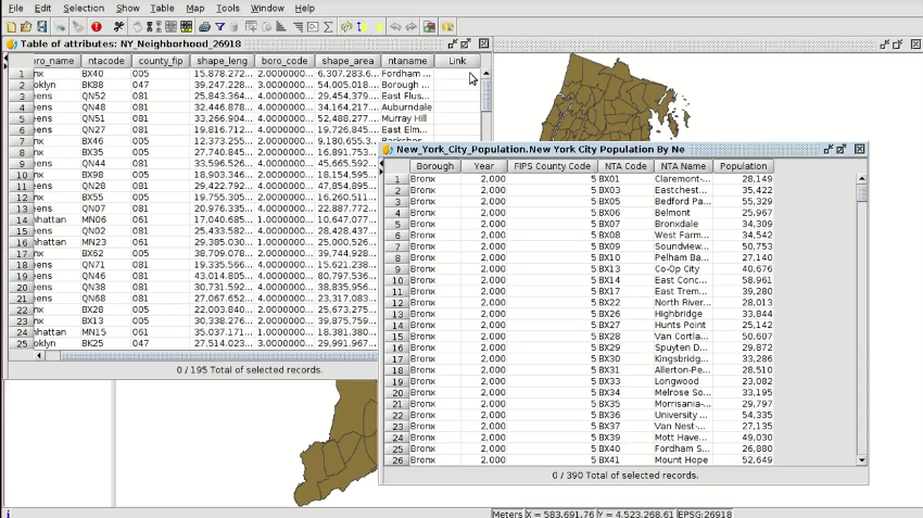 In our city council we can have external information in a table, and it would be interesting to georeference it, that means, to join the information of that table with the alphanumeric information of a vector layer.
For example, if we have a table with the population of each neighbourhood in our municipality, and we also have a vector layer with the neighbourhoods in our GIS, we can add the population of the first table to the graphic layer. For that we would need a field in both tables with common values. If we use the name of the neighbourhoods there can be different names (with or without the article…), so we can get an error. Then it will be recommendable to use a numeric field, where the numbers will be the same in both tables (we can use the neighbourhood code).
Here you have the second videotutorial of this fourth module:
Related posts:


Pingback: GIS applied to Municipality Management: Module 5.1 ‘Web services (Introduction to SDI)’ | gvSIG blog
Pingback: GIS applied to Municipality Management: Module 4.2 ‘Attribute tables (joining tables)’ – GeoNe.ws
Pingback: GIS applied to Municipality Management: Module 5.2 ‘Web services (Loading web services from gvSIG)’ | gvSIG blog
Pingback: GIS applied to Municipality Management: Module 5.3 ‘Web services (Non-standard services)’ | gvSIG blog
Pingback: GIS applied to Municipality Management: Module 6 ‘Add-ons manager’ | gvSIG blog
Pingback: GIS applied to Municipality Management: Module 7.1 ‘Editing (new layers, graphical and alphanumeric editing)’ | gvSIG blog
Pingback: GIS applied to Municipality Management: Module 7.2 ‘Editing (Derivative geometries)’ | gvSIG blog
Pingback: GIS applied to Municipality Management: Module 8.1 ‘Creation of point layers from tables (Geocoding: Points from a table with addresses)’ | gvSIG blog
Pingback: GIS applied to Municipality Management: Module 8.2 ‘Creation of point layers from tables (Event layers)’ | gvSIG blog
Pingback: GIS applied to Municipality Management: Module 9 ‘Hyperlink’ | gvSIG blog
Pingback: GIS applied to Municipality Management: Module 10 ‘How to convert cartography from CAD to GIS’ | gvSIG blog
Pingback: GIS applied to Municipality Management: Module 11 ‘Reprojecting vector layers’ | gvSIG blog
Pingback: GIS applied to Municipality Management: Module 12 ‘Geoprocessing’ | gvSIG blog
Pingback: GIS applied to Municipality Management: Module 13 ‘Layouts’ | gvSIG blog
Pingback: GIS applied to Municipality Management: Module 14 ‘Image georeferencing’ | gvSIG blog
Pingback: GIS applied to Municipality Management: Module 15 ‘gvSIG 3D’ | gvSIG blog
Pingback: GIS applied to Municipality Management: Module 16.1 ‘gvSIG Online (Publishing cartography, advanced editing…)’’ | gvSIG blog
Pingback: GIS applied to Municipality Management: Module 16.2 ‘gvSIG Online (Basic editing, hyperlink…)’ | gvSIG blog
Pingback: GIS applied to Municipality Management: Module 16.3 ‘gvSIG Online (Connection with gvSIG Mobile and enumerations)’ | gvSIG blog
Pingback: GIS applied to Municipality Management: Module 17 ‘gvSIG Mobile (Connection with gvSIG Desktop)’ | gvSIG blog
Pingback: GIS applied to municipality management: Certification and links to the complete course | gvSIG blog