
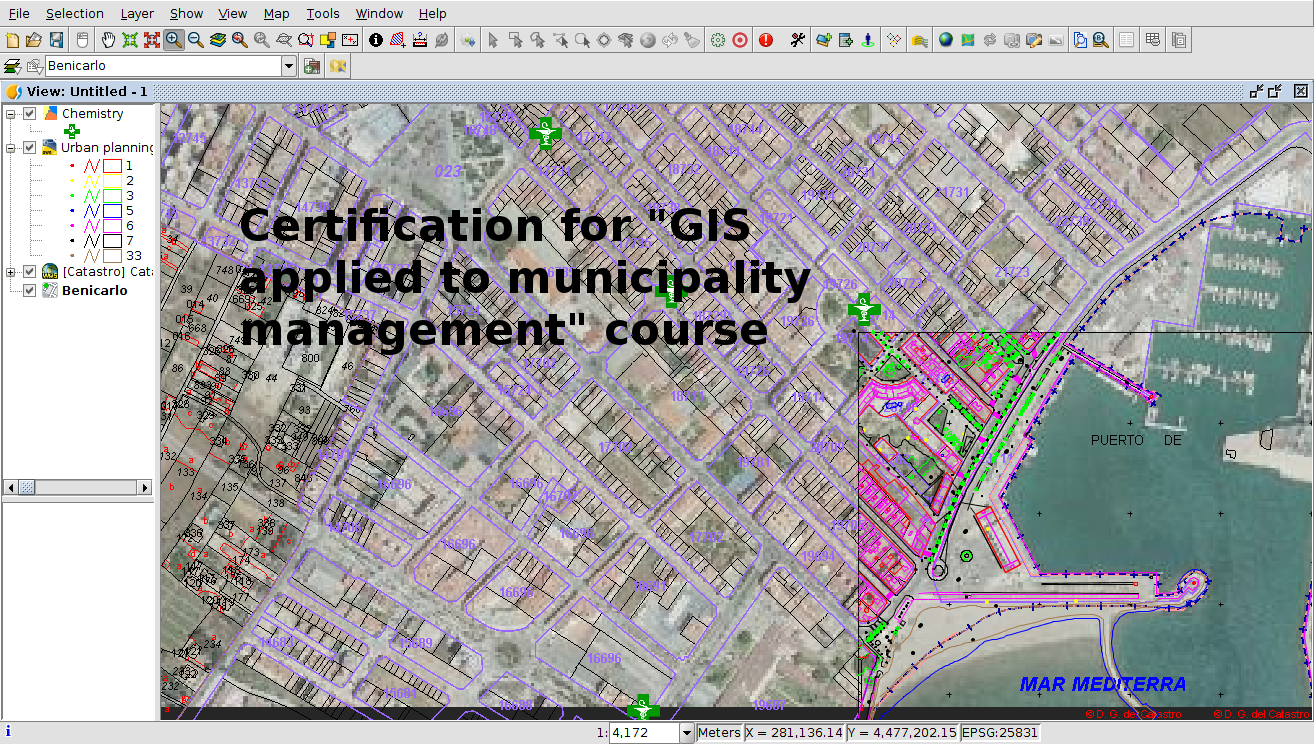
The certification of the course about Geographic Information Systems applied to municipality management is now available (this course is also available in Spanish and in French).
This certification period is opened after the publishing of the last modules of the course, but it will be open continuously, so that any user can get it at any moment when they finish the different modules.
To get this certification, a complete exercise must be completed, which includes some of the contents given during the course. Likewise, you must have at least 7 of the 10 existing activities correctly.
The exercise will validate the knowledge acquired during the course and will be evaluated by a tutor.
Apart from the delivery and passing grade of the exercise, the certification will have a minimum cost, necessary to cover the expenses related to the evaluation and certification. This cost will be € 30.
The certification will be issued by the gvSIG Association, and it will consist of two certificates:
- Course completion certificate, which will include all the information related to the training contents acquired.
- Official gvSIG User certificate, having completed the 90 credits necessary for this, and which gives the right to get the gvSIG Expert User certificate, passing the credits necessary for its validation, through the courses offered by the gvSIG Association.
The dedication time of the course is about 90 hours.
The exercise to be completed and the cartography to be used can be downloaded from the following link:
The steps to follow to send the exercise, as well as to make the payment in order to get the two certificates are explained in the first section of the practical exercise in detail.
If you haven’t taken the course yet, you can follow the different modules from the following links:
- Module 1: Differences between GIS and CAD
- Module 2: Introduction to reference systems
- Module 3: Views, layers, symbology, labelling
- Module 4.1: Attribute tables (alphanumeric information)
- Module 4.2: Attribute tables (joining tables)
- Module 5.1: Web services (Introduction to SDI)
- Module 5.2: Web services (Loading web services from gvSIG)
- Module 5.3: Web services (Non-standard services)
- Module 6: Add-ons manager
- Module 7.1: Editing (new layers, graphical and alphanumeric editing)
- Module 7.2: Editing (Derivative geometries)
- Module 8.1: Creation of point layers from tables (Geocoding: Points from a table with addresses)
- Module 8.2: Creation of point layers from tables (Event layers)
- Module 9: Hyperlink
- Module 10: How to convert cartography from CAD to GIS
- Module 11: Reprojecting vector layers
- Module 12: Geoprocessing
- Module 13: Layouts
- Module 14: Image georeferencing
- Module 15: gvSIG 3D
- Module 16.1: gvSIG Online (Publishing cartography, advanced editing…)
- Module 16.2: gvSIG Online (Basic editing, hyperlink…)
- Module 16.3: gvSIG Online (Connection with gvSIG Mobile and enumerations)
- Module 17: gvSIG Mobile (Connection with gvSIG Desktop)


Pingback: GIS applied to municipality management: Certification and links to the complete course – GeoNe.ws
Hi
Hi, how can I apply for above said course.
Hello Sahab! The course is free of charge, through videotutorials. It is not necessary to make any registration. You only have to follow the different modules that have been published.
At this post you have the links to every module and the information about the certification.
Enjoy it!
I am interested,how to apply?
Hi Saeed,
the course is free of charge, through videotutorials. It is not necessary to make any registration. You only have to follow the different modules that have been published.
At this post you have the links to each module and the information about the certification.
Enjoy it!
How do l apply for the course and how much is it in USD
Hello Jangano! The course is free, through videotutorials. You only have to pay for the certification if you want to receive it. It costs 30€, that would be about 38$ approx. When you pay it through Paypal you pay directly 30€.
Just send those who have completed the module their certificates on their designated email addresses, then it would free. otherwise its not free. 30 Euros still a lot of money for some of us.
Dear davgradengineer,
what you are getting here is a high quality course on GIS. The content was chosen and curated, exercises have been created, video material was planned, executed, edited and assembled. Everything was put up on a server for you to obtain all this knowledge and skills, which only a few years ago was only available at universities. It is now available to you for FREE – this does not mean that there was no effort, sweat and enthusiasm behind it to make it happen. All this is possible because people invested the effort to make this, and because it can be scaled to multiple users. Now if you want a certificate for you personally, that requires the control of your work by a tutor, which is an extra effort. I assume that you want the certificate because it gives you a financial advantage, because you can proof your skills to somebody. If that is the case, you could see the fee for the certificate as an investment, and given that you already get so much valuable material completely without any costs, I think you should consider this a fair offer. Anyways, it is up to you, you can get the skills anyhow without having the paper.
Best wishes,
Lorenz
By the way, I am not affiliated to this programme, but I highly appreciate it.
Understandable, the point is….Do not say it’s free because it’s not.
Can you see and follow all the contents/modules of the course (more than 5 hours!!! )? Yes, you can. Have you paid for it? No, you haven’t. Then it’s free.
If one cannot get their certificate at the end, pointless.
The certificate is optional. The course is free. It’s not pointless because you have learnt a free GIS tool without paying anything. It’s relevant, it’s very useful.
Please help me, I am eager to attend the courses, how can I get or register
Thank you
mohamed.chaaben@gmail.com
Felicidades y gracias por este curso importante. Mi pregunta es la siguiente: no puedo abrir los videos que vienen con los módulos, se quedan en negro y estáticos, como los puedo abrir?, gracias por su atención.
Gracias Juan. Creo que será por la configuración del navegador. ¿Has probado con otro? En todo caso, deberís aparecer en ellos un icono de enlace al vídeo en Youtube, y si no te aparece puedes ver directamente la lista de reproducción aquí: https://www.youtube.com/playlist?list=PLdoUYGiBhEtW3d0cT7PutU16-G2ejiHbh
En todos los vídeos tienes el enlace a la cartografía (que también puedes ver en los post del blog)
Por cierto, Juan, al escribir en castellano te había pasado el enlace a los vídeos en castellano. El post con todos los módulos los tienes aquí: https://blog.gvsig.org/2017/12/14/sig-aplicado-a-gestion-municipal-certificacion-y-enlaces-al-curso-completo/
y la lista de reproducción del curso en inglés es esta: https://www.youtube.com/playlist?list=PLdoUYGiBhEtUr-APrUkncNVpLtjbfe5OX
how could i wll apply for the above course
Hello Umer! The course is free of charge, through videotutorials. It is not necessary to make any registration. You only have to follow the different modules that have been published.
At this post you have the links to every module and the information about the certification.
Enjoy it!
Hi i would like to know if that if i did this course using another software Arcgis for Desktop is still valid and can send the results ans the small cost and get the Two Certificates..
Please i would like some advice.
Thank you,
Vasni
Hi Vasni,
this course is made on gvSIG, and the certification is for gvSIG.
gvSIG is open source, so you can download it from http://www.gvsig.com for free and do the course without problem.
We recommend you to check the application, where you will be able to do almost all that you do with ArcGIS, but without paying anything.
Best regards,
Mario
Pingback: Free course about crime mapping. GIS for criminology | gvSIG blog
Hello
How to apply this course.
Hello Fernando! The course is free of charge, through videotutorials. It is not necessary to make any registration. You only have to follow the different modules that have been published.
At this post you have the links to every module and the information about the certification.
And the course in Spanish is available here too: https://blog.gvsig.org/2017/12/14/sig-aplicado-a-gestion-municipal-certificacion-y-enlaces-al-curso-completo/
Enjoy it!
how can I apply for the above mentioned course..
Hi Parag,
The course is free of charge, through videotutorials. It is not necessary to make any registration. You only have to follow the different modules that have been published.
At this post you have the links to every module and the information about the certification.
Enjoy it!
Gis Engineer
Beautiful
I am intrested for training
Hi Gosai,
The course is free of charge, through videotutorials. It is not necessary to make any registration. You only have to follow the different modules that have been published.
At this post you have the links to every module and the information about the certification.
Enjoy it!
Is it need to download the GIS software?
Hi Tanweer,
yes, you need to download it for the practical part. The application is free. The practical part starts at module 3 and we explain how to download it in that module.
Enjoy the course!
Very nice and excellent and am also interested I want to be part of it
Hi Abubakar,
The course is free of charge, through videotutorials. It is not necessary to make any registration. You only have to follow the different modules that have been published.
At this post you have the links to every module and the information about the certification.
Enjoy it!
How to apply in this course
The course is free of charge, through videotutorials. It is not necessary to make any registration. You only have to follow the different modules that have been published.
At this post you have the links to every module and the information about the certification.
I am interested for this excercise please share more details on my email kushalishere@gmail.com
Hi Kushal,
The course is free of charge, through videotutorials. It is not necessary to make any registration. You only have to follow the different modules that have been published.
At this post you have the links to every module and the information about the certification.
Enjoy it!
I am interested for this excercise please share more details on my email kushalishere@gmail.com
borogaonxavier@gmail.com i m interested. how can i proceed? plz help
Hi Xavier,
The course is free of charge, through videotutorials. It is not necessary to make any registration. You only have to follow the different modules that have been published.
At this post you have the links to every module and the information about the certification.
Enjoy it!
Hi,
Is the certificate an E-certificate or a hardcopy? I reside in Nigeria which is my reason for asking.
Thanks
Hi Sarah, we send a PDF file by e-mail, it’s an E-certificate.
Best regards,
Mario
Hello Mario,
Which software package you use for training/exercise for this course? We are using ArcGIS.
Pingback: SIG aplicado a Gestión Municipal: Certificación y enlaces al curso completo | gvSIG blog
Pingback: Formação SIG Gratuita | Associação Portuguesa para os Sistemas de Informação Geográfica
Could I get the course free with my email?
Hi Woubishet,
the course is free of charge, through videotutorials. It is not necessary to make any registration. You only have to follow the different modules that have been published.
At this post you have the links to every module and the information about the certification.
Enjoy it!
Please send me the modules by email. It’s really helpful to me.
Hi Kamal.
the course is through videotutorials. They can’t be sent by e-mail.
It is not necessary to make any registration. You only have to follow the different modules that have been published.
At this post you have the links to every module and the information about the certification.
How can I register or attend the courses
Please help me, I am eager to attend the courses, how can I get or register
Thank you
Hi Yordanos,
the course is free of charge, through videotutorials. It is not necessary to make any registration. You only have to follow the different modules that have been published.
At this post you have the links to every module and the information about the certification.
Enjoy it!
Pls send me link in my email..
Hi Horace,
the course is free of charge, through videotutorials. It is not necessary to make any registration. You only have to follow the different modules that have been published.
At this post you have the links to each module and the information about the certification.
Enjoy it!
I want to apply for His course…..that is the branch I want to study in geography
Pingback: GIS audiovisual course audiovisual with Game of Thrones cartography | gvSIG blog
Pingback: Municipality platform for geographic information management | gvSIG blog
Nice program, still studying the modules
Pingback: Cours gratuit sur les systèmes d’information géographiques appliqués à la gestión des municipalités: premiers modules disponibles | gvSIG blog
Geographic Information systems
Hi,
I would like to know when is started this course?? How can I have access to ArcGIS, is it online or are you giving the code to have access for ArcGIS desktop?? Is it this module is available every week?? Did we have to points to pass or how is working?? Thank you
Hi,
the course was completely published, so you can start whenever you want. At this post you can access to every module.
This is gvSIG, not ArcGIS. gvSIG is open source, it’s free of charge and you can do almost all the tasks available in ArcGIS but without paying anything.
All the modules of the course are available at this post, through videotutorials. The course is free. And if you want to get the certification you only have to do the practical exercise available at this post and pay 30 euro if the exercises are correct.
Best regards
Am interested in learning the online course
Hi, how can I apply please?
Hi Benjamin,
the course is free of charge, through videotutorials. It is not necessary to make any registration. You only have to follow the different modules that have been published.
At this post you have the links to each module and the information about the certification.
Enjoy it!
Hello Admin,
Which software package you use for training/exercise for this course? We are using ArcGIS.
Hello Abu,
the course is done on gvSIG. It’s similar to ArcGIS. but gvSIG is open source, it’s free of charge and you can do almost all the tasks available in ArcGIS but without paying anything.
All the modules of the course are available at this post, through videotutorials. The course is free too.
And if you want to get the certification you only have to do the practical exercise available at this post and pay 30 euro if the exercises are correct.
Best regards
thanks for invite to training
Am interested, how can I apply ?
Hi Jeff,
the course is free of charge, through videotutorials. It is not necessary to make any registration. You only have to follow the different modules that have been published.
At this post you have the links to each module and the information about the certification.
Enjoy it!
Pingback: Cours gratuit sur les systèmes d’information géographiques appliqués à la gestion des municipalités: Certificat et liens vers le cours complet | gvSIG blog
Pingback: Learn GIS with free online courses and open source | gvSIG blog
Thank you very much for publishing this precious course for free. I would like to thank you everyone in this who made this happen, from teachers to writer of this post here, even more so the gvSIG team and its developers.
I’m interested. When is the course starting?
Hi Marrien,
the course is open permanently. You can start whenever you want. It’s free of charge, through videotutorials. It is not necessary to make any registration. You only have to follow the different modules that have been published.
At this post you have the links to each module and the information about the certification.
Enjoy it!
Thank you for making this available to everyone. I appreciate the effort that has gone into it. It’s a great way to get hands on experience of using the software,
Thank you for the opportunity, I would like to participate.
Hi Chamsiddine,
the course is free of charge, through videotutorials. It is not necessary to make any registration. You only have to follow the different modules that have been published.
At this post you have the links to each module and the information about the certification.
Enjoy it!
Pingback: Online courses with free certification about Geographic Information Systems | gvSIG blog
Pingback: Extending free certification for online courses about Geographic Information Systems til September | gvSIG blog
Am interested to join the free courses, how can I participate?
Hi John, the course is free of charge, through videotutorials. It is not necessary to make any registration. You only have to follow the different modules that have been published.
At this post you have the links to each module.
And the certification is currently free too. If you send the exercises you won’t have to pay for the certification (https://blog.gvsig.org/2020/05/06/extending-free-certification-for-online-courses-about-geographic-information-systems-til-september/).
Enjoy it!
HI,
following up withthe tutorial, but the exercise folder as downloaded does not contain all the files which the tutorial shows.
how do i get them?
thanks
Hi Yanik, if you access to any module, there’s a link to download the cartography to use for that module, for the videotutorials.
And at this post you have the cartography only for the practical exercise in case that you want to get the certification.
Hi, what’s your recommendation if i want to start from A to Z to be professional GIS ??
With which courses if have to start
Thank you
Hi Aya, I recommend this course because it’s very complete, and it includes some theoretical modules to help to understand GIS in a better way. It includes videos about reference systems, web services…