gvSIG Desktop 2.3: Manual en español disponible

gvsig_sig_softwarelibre_manualHace unos días anunciamos la nueva versión de gvSIG, que como ya sabréis viene repleta de novedades.

Ya tenemos disponible el manual en español, tanto en PDF como para su consulta online. En los próximos días además haremos algún cambio en el manual online para facilitar su navegación.

Podéis encontrar ambas modalidades del manual en:

http://downloads.gvsig.org/download/web/html/es/html/

En breve esperamos contar también con el manual en inglés, gracias a la buena respuesta que está teniendo el llamamiento a colaborar en la traducción del mismo.

Este manual se suma a la completa documentación de scripting recientemente publicada para gvSIG 2.3:

http://downloads.gvsig.org/download/web/html/es/html/scripting_devel_guide/2.3/index.html

Posted in gvSIG Desktop, spanish | Tagged , | Leave a comment

12as Jornadas Internacionales de gvSIG: Programa de talleres e inscripción

gvsig_gis_open-source_workshops

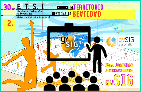
Este año las Jornadas Internacionales de gvSIG tendrán entre sus actividades un buen número de talleres. Debido al interés que están mostrando estas jornadas y en previsión de aforos completos se ha lanzado una inscripción a cada uno de los talleres. De este modo, además, en caso de completar el aforo, se podría plantear el replicar algunos de ellos. Como todos los años todas las actividades de las jornadas son gratuitas, incluyendo los talleres.

Las plazas disponibles varían según el taller (y la sala donde se imparte). Algunos tienen plazas muy limitadas, por lo que os aconsejamos inscribiros en aquellos que os interesen lo antes posible.

En cualquier caso, son 9 talleres que discurren en sesiones paralelas, así que comprobad el horario para evitar coincidencias.
IMPORTANTE: Es necesario inscribirse en las jornadas de gvSIG para asistir a los talleres.

Además del certificado de asistencia a las Jornadas emitido por la Asociación gvSIG, cada uno de los talleres permitirán obtener un certificado del Centro de Formación de Postgrado de la Universidad Politécnica de Valencia.


Os dejamos con los enlaces a cada uno de los talleres, desde donde podréis realizar la inscripción:

INTRODUCCIÓN A GVSIG: Orientado a nuevos usuarios que quieren conocer las principales funcionalidades de gvSIG, cómo crear proyectos nuevos, crear vistas, añadir cartografía y gestionar los sistemas de referencia. También aprenderá a manejar las tablas de atributos. Se mostrarán varias herramientas de edición y geoprocesamiento. Finalmente el alumno aprenderá cómo crear mapas, para poder imprimir o exportar a pdf.
https://www.cfp.upv.es/formacion-permanente/cursos/introduccion-a-gvsig_idiomaes-cid51447.html

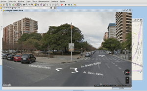
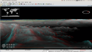
NOVEDADES GVSIG 2.3: Mediante ejercicios prácticos se hará un recorrido por las novedades de la última versión de gvSIG: Extrusión 3D, acceso a servicios de mapas de Google y Bing, LiDAR, Segmentación dinámica, etc.
https://www.cfp.upv.es/formacion-permanente/cursos/novedades-gvsig-2-3_idiomaes-cid51442.html

GVSIG APLICADO A LA TOPOGRAFÍA: Tiene como objetivo conocer las principales funcionalidades de gvSIG relacionadas con la topografía, aplicadas a la realización de levantamientos, cambios de sistemas de referencia o creación de ficheros GML (válidos para la Dirección General de Catastro, España).
https://www.cfp.upv.es/formacion-permanente/cursos/gvsig-aplicado-a-la-topografia_idiomaes-cid51446.html

GVSIG APLICADO A ARQUEOLOGÍA: Conocer las principales funcionalidades de gvSIG relacionadas con la arqueología, aplicadas tanto al estudio de fenómenos regionales como al estudio de un yacimiento concreto.
https://www.cfp.upv.es/formacion-permanente/cursos/gvsig-aplicado-a-arqueologia_idiomaes-cid51445.html

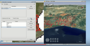
GEOPAPARAZZI AND GVSIG: Permitirá conocer el funcionamiento del SIG móvil (Android) Geopaparazzi y su integración con gvSIG.
https://www.cfp.upv.es/formacion-permanente/cursos/geopaparazzi-and-gvsig_idiomaes-cid51520.html

R EN GVSIG: Para los interesaos en la estadística y los SIG, nos ayudará a conocer lo básico para movernos en el entorno de desarrollo de gvSIG y manejarnos con el Módulo de Scripting, disponer de los conocimientos mínimos para poder pasar información a funciones ya escritas sobre R, poder ejecutarlas, y cargar los resultados obtenidos de vuelta en gvSIG.
https://www.cfp.upv.es/formacion-permanente/cursos/r-en-gvsig_idiomaes-cid51453.html

INTRODUCCIÓN AL DESARROLLO EN GVSIG CON SCRIPTING: Permitirá conocer el uso general del Módulo de Scripting que viene integrado en gvSIG, el uso de las herramientas de ayuda para el desarrollo y tener conocimientos suficientes para realizar herramientas básicas con interfaz gráfica e interacción con diferentes fuentes de datos.
https://www.cfp.upv.es/formacion-permanente/cursos/introduccion-al-desarrollo-en-gvsig-con-scripting_idiomaes-cid51467.html

DESARROLLO AVANZADO EN GVSIG CON SCRIPTING: Curso avanzado de scripting en gvSIG que permitirá profundizar en la potencialidad de desarrollo con Python, realizar herramientas avanzadas con interfaz gráfica y empaquetarlas para su distribución.
https://www.cfp.upv.es/formacion-permanente/cursos/desarrollo-avanzado-en-gvsig-con-scripting_idiomaes-cid51452.html

INTRODUCCIÓN A HOTOSM: Nos enseñará a cómo colaborar en activaciones del equipo humanitario de OpenStreetMap y a realizar tareas de edición sencilla en OpenStreetMap.
https://www.cfp.upv.es/formacion-permanente/cursos/introduccion-a-hotosm_idiomaes-cid51471.html

Espectacular el programa de talleres, ¿verdad?

Posted in events, Geopaparazzi, gvSIG Desktop, software libre, spanish, training | Tagged , , , | Leave a comment

3as Jornadas gvSIG Perú: Programa provisional e inscripciones

Ya está disponible el programa provisional con las ponencias y talleres que se van a dar en las 3as Jornadas gvSIG Perú, que tendrán lugar los días 27 y 28 de octubre en Lima.

En estas jornadas se presentarán, entre otras, ponencias sobre catastro municipal, cuencas hidrográficas o fiscalización tributaria entre otras, y talleres sobre cómo comenzar a utilizar gvSIG, como implementar una de Base de Datos Espacial, Scripting en gvSIG con Python, o gvSIG aplicado a Catastro Municipal.

Por otro lado, debido a problemas en el servidor de registro, la inscripción a las jornadas recomendamos se vuelva a realizar a través del formulario de la web de las jornadas. Tanto si ya te habías registrado previamente como si no lo habías hecho aún, recomendamos que realices la inscripción de nuevo. Recordamos que el aforo es limitado.

¡Os esperamos!
imagen_jornadas_gvsig_peru_2016


Posted in gvSIG Desktop | Leave a comment

8as Jornadas de Latinoamérica y Caribe de gvSIG: Programa provisional de ponencias y talleres, e inscripciones

Ya está disponible el programa provisional con las ponencias que se van a dar en las 8as Jornadas de Latinoamérica y Caribe de gvSIG, que tendrán lugar los días 20 y 21 de octubre en Montevideo (Uruguay).

También se han abierto las inscripciones a los talleres, con cupos limitados, y que pueden hacerse desde el siguiente formulario. Los talleres que se realizarán, totalmente gratuitos, son los siguientes:

  • Base de Datos Geográfica – PostGIS
  • gvSIG avanzado
  • GeoServicios con GeoServer
  • R aplicado a lo espacial

Por otro lado, debido a problemas en el servidor de registro, la inscripción a las jornadas recomendamos se vuelva a realizar a través del siguiente formulario. Tanto si ya te habías registrado previamente como si no lo habías hecho aún, recomendamos que realices la inscripción de nuevo. Recordamos que las jornadas son gratuitas, y el aforo es limitado.

¡Os esperamos!

8as_J_LAC_gvSIG-home


Posted in community, events, spanish, training | Tagged | Leave a comment

Eulogy and risks of two new open source initiatives in Europe: Bulgaria and the Valencian Community.

open-hero_xxx

Two new legal initiatives to promote the use of open source have been announced in the last months, both of them aligned with the current European Union strategies like the Open Source Strategy and the ISA-Developing and sharing IT solutions for less bureaucracy.

One is the national initiative approved by the Bulgarian parliament for the mandatory use of open source for IT services contracts, and in particular for software to be used in its public administration. This legislation is a clear step towards higher technological independence via the development of local business and the reutilization of code by different government bodies, a decision that provides reassurance to their citizens that the electronic public administration functions adequately. Additional advantages of this measure include better security, a reduction of costs related to the acquisition and renewal of private licences – which are in most cases a dreadful monopoly – plus an increase of hardware longevity.

The other initiative is particularly beneficial to the gvSIG project, as it has been originated in the Valencian Community, the same region where the project was born and where its headquarters are. This initiative, the Mocion 12/IX which was seconded by all parties in the plenary session on 26th May 2016, seeks to promote the use of open software in the public administration of this region.

The reading of this new measure is highly recommendable as it is short and precise regarding further steps, which include the following: to define political actions and plans to promote the use of open source software in the autonomous administration; to incorporate clear guidance for the preferential use of open source in the digital transformation plan (Plan de Transformacion Digital) and all forthcoming information system projects; to promote the implementation of open licenses for  current and future contracts for the externalization of its information system and the support to business that follow the open source models, a decision that would open new business opportunities for the ICT Valencian SMEs; to prioritize the development of open source projects funded by the European Union funding schemes for open source initiatives.

Of special interest is the point noting the publication of biannual progress reports based on KPIs that would allow assessment according to independent criteria. Following on from this, the Consell has confirmed that it will report on the fulfillment of this measure after the six months of its approval. This announcement breaks new boundaries with regards to other legal initiates that lacked such clear monitoring commitment, an issue that was sadly present in previous open source initiatives.

When I previously discussed the concept of smart cities, which could now be extrapolated to include ‘smart government’, I explained the difference between political and technical decisions, and sated that opting for open software was a political decision similar to the choice between private or public road management. Up to now, once the legal framework was approved, the major difficulty stopping its practical implementation was usually the technicians in charge of its implementation. This resistance to change, which looks more like a preference for ease and inactivity instead of coping with the extra efforts required for implementing any changes, could be compared to the issues found during the abolition of slavery, which probably found arguments to the likes of making sure that the job was done as a way to oppose to it. This may sound like an exaggeration, but I myself have heard this type of argument for years, comments that exude apathy, lack of initiative and opposition to a change that is so clearly beneficial to all.

Therefore huge congratulations to the Bulgarian and Valencian citizens and well done to their politicians who have understood that technology is one of the major strategical sectors of the XXI century and who, consequently, have created laws to be able to control it, a decision only possible via open source software. Furthermore, I would also like to advise citizens, and particularly those working in open source associations and communities, and those SMEs who would benefit from this political measure, to monitor its implementation and evolution. This way we will avoid hearing excuses and the type of reluctance previously mentioned, and will be able to see the materialization of this policy in our daily lives.

Posted in Business, english, gvSIG Desktop, opinion, software libre | Tagged | Leave a comment

gvSIG busca traductores

gvsig_english_spanish

Hola a todos y todas. Como sabéis recientemente hemos publicado gvSIG 2.3, una nueva versión del SIG de escritorio en software libre plagada de novedades, tanto a nivel funcional como de scripting.

Tenemos pendiente publicar el manual de gvSIG 2.3, aunque ya lo tenemos prácticamente terminado en castellano. También hemos publicado en castellano la documentación de scripting…y ahora nos queda pendiente tener todo este material en inglés, lo que sin duda ayudará a divulgar y ampliar la comunidad de usuarios y desarrolladores de gvSIG Desktop en la comunidad angloparlante. Y a más comunidad, más rápido crecerá el proyecto y todos nos beneficiaremos de ello.

Para estas tareas de traducción os pedimos vuestra ayuda. Cuanto más seáis los voluntarios más rápido podrá disponer la comunidad de toda esta documentación en inglés. Aunque puedas dedicarle poco tiempo, siempre será bien recibida tú aportación.

Para colaborar simplemente escríbenos un correo a info@gvsig.com e indicanos si prefieres traducir documentación de usuario o de scripting.

¡Muchas gracias por adelantado!

Posted in community, spanish | Tagged , | 1 Comment

Vídeo del Seminario de introducción a la programación en gvSIG mediante scripting (Python)

¿Aprender a programar en gvSIG en 1 hora? Este vídeo ayuda a que así sea.

Y es que ya está disponible la grabación relativa a este webinar de introducción a la programación en gvSIG mediante scripting (Python) impartido como parte de las actividades del Máster Oficial en Valoración, Catastro y Sistemas de Información Territorial de la Universidad Miguel Hernández.

El objetivo de este seminario es conocer, mediante una serie de sencillos ejercicios prácticos, las posibilidades del módulo de scripting en gvSIG y el proceso de manipulación de datos espaciales para la creación de capas a partir de otras existentes.

Dentro vídeo…

Posted in gvSIG Desktop, spanish, training | Tagged , , , , | Leave a comment

Vídeos sobre las novedades de gvSIG 2.3

Ya están disponibles los vídeos relativos a los webinars sobre las novedades de de gvSIG Desktop 2.3. impartidos como parte de las actividades del Máster Oficial en Valoración, Catastro y Sistemas de Información Territorial de la Universidad Miguel Hernández.

Por un lado el vídeo en el que presentamos cada una de las novedades funcionales de gvSIG 2.3, con ejemplos de las nuevas herramientas disponibles en esta versión:

Por otro el vídeo sobre las novedades relativas al scripting en gvSIG 2.3. ¡Son tantas que dedicamos un webinar sólo a ellas!

Esperemos que os gusten.

Posted in gvSIG Desktop, spanish | Tagged , , | 1 Comment

Premios al software libre: gvSIG nominado en 4 categorías

trofeo_programa_sl

El reconocimiento al proyecto gvSIG se muestra de muy diversas formas y una de ella es su presencia en distintos premios. Hoy se han anunciado los nominados a los “Premios al software libre” de este año y gvSIG está presente en cuatro de las seis categorías existentes. Todo un éxito para la Asociación gvSIG que se suma a los galardones recientemente recibidos de la NASA.

Estos Premios que cuentan ya con ocho ediciones, están organizados por PortalProgramas, un canal de descarga de software con más de 12 años de experiencia y tienen como objetivo premiar a los programas que más han contribuido al avance tecnológico durante este año. Unos premios en los que la votación popular tiene bastante importancia.

En cuanto a las motivaciones de estos premios creo que se explica perfectamente con este texto extraído de la web:

Hemos crecido al lado del software libre y pensamos que es una apuesta de presente y de futuro que ayuda enormemente al desarrollo de la tecnología actual, aunque muchas veces de forma invisible, formando parte de otras tecnologías. Desde hace años apostamos por promocionar el software libre porque promoverlo es una forma de ayudar a la sociedad.

Pues bien, a partir de hoy día 4/10/2016 y hasta el 24/10/2016 podéis votar en cada una de las categorías a vuestro software favorito…¡que esperamos que sea tecnología made in gvSIG!

En cualquier caso y como dicen los organizadores, con este tipo de eventos no importa quien gane porque siempre gana el Software Libre.

Para votar a nuestros nominados os dejamos los enlaces directos. En cada uno de ellos podréis votar en la/s categoría/s a las que están nominados:

Posted in Geopaparazzi, gvSIG Desktop, spanish | Tagged , | 2 Comments

gvSIG 2.3 is now available!

The new version of gvSIG Desktop, the open source GIS, is now available to download.

This new version is an important step at the gvSIG evolution, because of its multiple improvements and novelties in a functional level as well as in an architecture one. 

You can download gvSIG 2.3 from here:

http://www.gvsig.com/en/products/gvsig-desktop/downloads

A here you have a list of novelties:

Distribution for Windows 64 bits.

This new distribution has been added to the existing ones: Windows 32 bits and Linux 32 and 64 bits, as installable and portable versions.

 001_23_xxx
 002_23_xxx Portable distribution for Mac OS X

We release this official distribution for users of this operating system for the first time.

More information: https://blog.gvsig.org/2016/09/14/towards-gvsig-2-3-portable-distribution-for-mac-os-x/ 

GDAL: projections and raster access library

From this version we use GDAL as projections and raster information access library.

One of the consequences of this change is the access to lots of new formats (MID/MIF de Mapinfo, Geojson, CityGML, etc.) through GDAL.

More information: in: https://blog.gvsig.org/2016/03/08/on-the-road-to-gvsig-2-3-new-available-formats-ogr-gdal/

 003_23_xxx

New installer with 64 bits support

New geometry library

More efficient support for multigeometries

Java 8 support

Automatic creator of gvSIG Debian de gvSIG

PRJ format (projections) reading and writing

It is a file that is attached to an information layer (shapefile, raster…) that has information about its coordinates reference system.

More information:

https://blog.gvsig.org/2016/03/08/on-the-road-to-gvsig-2-3-read-and-write-prj-files-projections/

 004_23_xxx
 005_23_xxx R: Statistics in gvSIG

R statistics library support through Renjin or integrating R directly.

More information:

https://blog.gvsig.org/2016/03/17/running-r-source-code-from-gvsig-2-3-through-renjin/

and here:

https://blog.gvsig.org/2016/09/29/towards-gvsig-2-3-r-extension

Lots of improvements in scripting

There are a lot of improvements in the Scripting module in gvSIG 2.3. Now it is very easy to develop in gvSIG

More information in these links (posts in Spanish will be translated soon):

https://blog.gvsig.org/2016/09/06/towards-gvsig-2-3-new-integration-at-the-scripting-libraries/

https://blog.gvsig.org/2016/08/31/camino-a-gvsig-2-3-compatibilidad-y-cambios-en-scripts/

https://blog.gvsig.org/2016/09/01/camino-a-gvsig-2-3-ejemplo-de-script-con-la-nueva-implementacion/

https://blog.gvsig.org/2016/09/05/camino-a-gvsig-2-3-insertar-nuevos-geoprocesos-mediante-scripting/

https://blog.gvsig.org/2016/09/12/camino-a-gvsig-2-3-nuevas-funcionalidades-en-el-scripting-composer/

https://blog.gvsig.org/2016/09/20/camino-a-gvsig-2-3-autoarranque-de-scripts-al-iniciar-gvsig/

 006_23_xxx
 007_23_xxx Dynamic segmentation/Linear Reference System (LRS)

Tool to work with this spatial reference method in which the positions of the elements are referred to measurements along a linear element.

This ability involves a set of tools that let define routes, calibrate each route from the milestones, edit the M coordinate of an element, depict it and generate new layers that support dynamic segmentation.

More information in these links:

https://blog.gvsig.org/2015/11/24/on-the-road-to-gvsig-2-3-dynamic-segmentation-lrs-i/

https://blog.gvsig.org/2016/02/18/on-the-road-to-gvsig-2-3-dynamic-segmentation-ii/

https://blog.gvsig.org/2016/02/22/on-the-road-to-gvsig-2-3-dynamic-segmentation-iii/

https://blog.gvsig.org/2016/02/26/on-the-road-to-gvsig-2-3-dynamic-segmentation-iv/

https://blog.gvsig.org/2016/02/27/on-the-road-to-gvsig-2-3-dynamic-segmentation-v/

https://blog.gvsig.org/2016/02/27/on-the-road-to-gvsig-2-3-dynamic-segmentation-vi-and-final/

https://blog.gvsig.org/2016/02/29/on-the-road-to-gvsig-2-3-dynamic-segmentation-in-4-videos/

Google Maps, Bing Maps and Street View

Possibility to add Google Maps and Bing Maps map services.

Access to Google Street View.

More information: https://blog.gvsig.org/2016/06/22/towards-gvsig-2-3-bing-maps-google-maps-and-google-street-view/ 

 008_23_xxx
 009_23_xxx New OpenStreetMap servers
Access to new OSM tile services, adding Stamen: Toner, Watercolor and Terrain.More information: https://blog.gvsig.org/2016/08/05/towards-gvsig-2-3-new-osm-openstreetmap-servers/ 
LiDAR data reading and writing 

LiDAR data support in .LAS format

More information: https://blog.gvsig.org/2016/06/20/towards-gvsig-2-3-lidar-data/

 010_23_xxx
 011_23_xxx CSV (Wizard) importer

A wizard makes CSV loading easy, as table as well as layer

More information: https://blog.gvsig.org/2016/08/08/towards-gvsig-2-3-csv-wizard-importer/

New editing tools

Editing module continues improving with 3 new tools: change sense, curve to polyline, and parallel line.

Distributions automatic generator

Plugin that allows to configure and create gvSIG distributions automatically for any operating system, customizing its working, OGC services, EPSG, appearance…

3D View improvements

2D to 3D views reprojection support

Vector data support in 3D views

3D animations

Extrusion

More information:

https://blog.gvsig.org/2016/06/20/towards-gvsig-2-3-reproject-2d-view-into-a-3d-view/

http://jgrasstechtips.blogspot.com.es/2016/06/extrusion-for-3d-vector-view-in-gvsig.html

 012_23_xxx
 013_23_xxx Anaglyphs

Possibility to view 3D Views in Anaglyph mode.

More information:

https://blog.gvsig.org/2016/09/09/towards-gvsig-2-3-anaglyph/

Animations

Animations generator for 3D Views.

More information: https://blog.gvsig.org/2016/09/06/towards-gvsig-2-3-3d-animations/

 014_23_xxx
 015_23_xxx

Cadastre browser (Spain)

Users in Spain will be able to look for parcels by cadastral reference or location.

More information: https://blog.gvsig.org/2016/06/02/camino-a-gvsig-2-3-buscador-de-referencias-catastrales-espana/

Bookmarks

We will have a dataset catalogue with the cartography that we usually use, and they will be able to be loaded in our Views in a quick way.

More information: https://blog.gvsig.org/2016/09/20/towards-gvsig-2-3-bookmarks/

 016_23_xxx

Automatic detection of heights

Building detection and height comparative between layers from LiDAR data

Online documentation

Online documentation available for users and developers

And we have to add several small improvements besides error correction (bugs) that have been identified. Here you have some of these small improvements: update of all the languages (more than 30), tool to add layers to locator from the ToC, Groovy version updated for scripting, new INSPIRE symbol libraries, usability improvements…

If you have read all this post, you sure will want to download and test the new version. From today we start to work in gvSIG Desktop 2.4, and the releasing phase will start in December.

Finally, we want to tell you that your help, although it is small, can be very important to continue improving gvSIG. We encourage you to collaborate:

https://blog.gvsig.org/2016/05/12/contributing-to-gvsig-or-bidirectional-collaboration/

Posted in development, english, gvSIG Desktop, testing, training | Tagged | 2 Comments